Stop Press! 13 000 to 15 000 cedars! – read all about it below!
 |
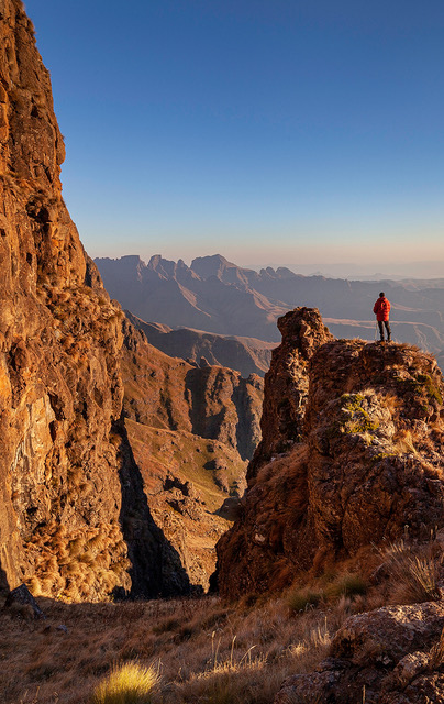
| Photo ©Geoff Spiby |
1. Save R54 and order Hike the Cederberg #2 now ...
2. Counting cedars – how we did it [and get your free kml file]
3. My Cederberg Story – Olive Nieuwoudt
4. Kabouterland: more great stuff from Dawie Burger
1. Save R54 and order Hike the Cederberg #2 now ...
Hike the Cederberg #2 is at the printer ... with nearly 200 more names, quite a few path ‘tweaks’ and 13437 trees – mostly cedars – correctly located.
As a special offer to all on our blog list, you can pre-order and get a 20% discount [=R54] if you order before 31 October.
# by Credit card or SID – go to www.slingsbymaps.com and order the map through our server, MonsterPay. After you’ve entered your name and address, etc, a screen will open which includes [in rather small print] the line ‘Do you have a gift certificate or promotional code?’
Enter this code in the space provided: HikeC#2
Click on Redeem Gift certificate
... and you’ll get a 20% discount on this – and any other maps you order.
# by EFT – email peter@slingsby.capetown for banking details.
2. Counting cedars – how we did it [and get your free kml file]
Since our previous report on counting and locating the Cederberg’s surviving cedars we found better quality shots that greatly enhanced the process – so here’s a photo-essay of the process.
a. We saved the relevant set of shots from Google Earth Pro. If the areas we wanted were under cloud we went back to earlier shots.
 |
| a. ‘Raw’ Google Earth screenshot |
b. We used an auto-adjust to enhance the pics
 |
| b. enhanced Google Earth screenshot |
c. We imported the pics into our graphics programme, geo-positioning them correctly. Then we ringed all the trees we could positively ID as living cedars.
 |
| c. identifiable cedars ringed |
This was easiest in areas burned in the 2013 fires, because the cedars show up as distinct green dots; there’s an area near Krakadouw which has not burned and here the process was difficult; we may have selected some incorrect species – affecting perhaps 200 trees. Nevertheless, the cedars are usually a distinctive colour, and their shadows always give them away.
Where possible we correlated these pics with photos taken from the nearest paths: Matt Britton’s 19000-photo collection was useful here! These often revealed that what looks like a ‘dead’ tree in the air photo in fact has green leaves on at least a part of the tree.
We also used Rudolf Andrag’s 1970s map as a check that we were indeed probably seeing cedars.
 |
| d. red circles converted into semi-transparent green dots, 0.6 mm diameter |
d. Our red circles were then converted into 0.6 mm green dots for inclusion on the map.
A small problem here is that a scatter of trees may appear as a bit of a closed-canopy forest on the map: because of the scale the 0.6 mm dots overlap quite often. However, if we had made the trees their correct scale [often less than 0.1 mm] they’d be invisible on the map!
 |
| e. how the scatter of tree-dots appear on the final map; keyed as ‘Trees: mostly cedars’ |
e. If you would like a free kml file that you can import into Google Earth and that geo-locates the 13 437 trees we found, please email me at peter@slingsby.capetown. Our distribution of trees – especially cedars – needs to be checked in the field and if you’d like to contribute your observations we’ll consider holding a free edition #3 map for you one day in the future!
3. My Cederberg Story – Olive Nieuwoudt
‘My Cederberg Story’ by Olive Nieuwoudt is the Cederberg book we have all been waiting for. Privately published by Olive’s daughter, Susan de la Bat, it’s available from Susan [email me for her details] for only R100. That’s too inexpensive, Susan! It’s 220 pages rich with information and liberally sprinkled with photographs, and any one of us would easily pay R200 for this fascinating book.
Olive’s first visit to Kromrivier was in 1954, and she spent the rest of her life in the Cederberg, until moving to Clanwilliam a few years ago. The book is a wonderful accumulation of her experiences, her insights, and research into the origins of the farms and their families.
After a chapter on the history of the Nieuwoudt family Olive describes the history and the stories around the four ‘core’ farms that shaped her life married to Rens Nieuwoudt – Vogelfontein, Matjiesrivier, Kromrivier and Dwarsrivier. She includes her own story and how she and her family left Britain as wartime ‘refugees’, her childhood in Cape Town, and her discovery of Kromrivier [and of Rens, of course!] In the next section she expands the boundaries of her tale to include Driehoek, Algeria, Grootrivier, Nuwerus, the Oasis, Keurbosfontein and even two farms that have long gone – Perdekloof and Eikeboom. She ends – essentially – with the story of Wupperthal, the Cederberg village and mission which has shaped the lives and the past of so many of the families who live and work in the Cederberg.
 |
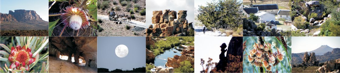
| Some of the fascinating historic photos in Olive’s book |
Two very minor criticisms – one understands the need to limit the number of pages of any book, but quite a few of the photos are very small and the detail is often hard to see. My other [small!] quibble is that although everyone’s date of birth is meticulously recorded, we’re not always given a date when events took place. For example, we know that Gerrit Nieuwoudt was born in 1799; he gave Matjiesrivier to his daughter [born 1825] and her husband [born 1811], but we don’t know when they took over the farm.
Another more serious grouse is that there is no index, which would be so very useful in a book of this kind.
But those small things aside, for only R100 you get a very fine contribution to the literature and history of the Cederberg. Olive’s Foreword ends with these words: “The Cederberg has shaped my heart, my soul and my life. I hope that as you read My Cederberg Story, I will play some part in making it part of your life too.” Thank you so much, Olive – your book does just that!
Olive and Petrus Hanekom [‘Diepspore’, see here ] have set the ball rolling with their personal histories of the Cederberg. Let’s hope that more of the Ceder People will follow suit!
4. Kabouterland: more great stuff from Dawie Burger
Dawie Burger and his friend Geoff Spiby went in serch of Alex Basson’s legendary ‘Kabouterland Cave’. They could not find the cave but we finish off here with a photo essay of some of Geoff’s magnificent photos of the Kabouterland area. These pics, please note, are all © to Geoff Spiby.
Alles van die beste
Kaartman September 2015