2. Bushmanskloof revisited
3. Names from Pip Nieuwoudt
4. Mount Oompie
5. Pics from Graham Bellairs, and GPS altitudes – be warned!
6. Tontelbos
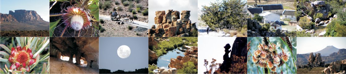
1. New Cederberg Touring map
In September 2013 Geoff and Jeanne Ward joined us in researching the area north of the Doring River for edition #11 of our Cederberg Touring map. The map now includes an extension north that takes in the spring flower districts of Nieuwoudtville, Vanrhynsdorp, Calvinia and Loeriesfontein. We’re working hard at it and it should hit the shelves early in September.

A new feature of this map will be roads marked with a warning. It was very wet last September and at one stage we found ourselves on a road – a spectacular byway that we’d normally always recommend – that was rapidly turning into bottomless mud. We’d left all our food, water and bedding at our Nieuwoudtville accommodation, and as we groaned our way out of the incipient quicksand we realised that the nearest help was probably at least 40km away. There might be no other vehicles passing that way for days; there’s no cellphone reception, of course, and many of the farms marked on the map are no longer occupied. It’s startling to realise that if you want to explore those back roads you should be equipped as though you were off to the Okavango – with at least two vehicles, two spare wheels and enough kit to survive a night or two. And it’s all scarcely more than 300km from Cape Town, nogal.
If there is anything else special that you’d like to see included on the touring map, there’s still time to submit your very welcome suggestions ...
 |
| The shaman image at Fallen Rock Cave, Bushmans Kloof |
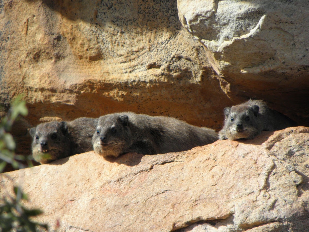
At the kind invitation of Jill Wagner Mrs Kaartman and I revisited some of the rock painting sites at Bushmans Kloof. The fundamental economics of our cartographical empire ensure that we are not frequent visitors there, but nearly twenty years ago we were invited to produce a booklet of the Kloof’s magnificent rock art. That was a real privilege then, but there was no digital photography in those far off days, so it was a treat to be able to return, modern cameras at the ready, to Fallen Rock, Elephant Hunt, Bleeding Nose and the other sites for which BK is so well known. Ably led by Head Guide Gerhard we also enjoyed a loping caracal, a hungry eagle and some sun-worshipping dassies on the snooze.
The Agter-Pakhuis as a whole, especially Bushmans Kloof and Travellers Rest, is the richest area in the whole wide world for prehistoric rock art, and if you’ve never been there it’s high time you went. The rock art is a legacy that more than anything else in our beautiful country unites us all across all our cultural differences. Why? Because the San were [are] the oldest race in the world, and we are all descended from them.
At a recent gathering Janette Deacon pointed out the importance of that legacy. Not only are the San the oldest race, South Africa has the most and the oldest human fossils, the oldest rock engravings, and a greater repository of rock art than in the rest of Africa and Europe combined. Although the famous Lascaux paintings are considered to be older than any of our cave art, excavations on our south coast have unearthed painted stones that are three or four times older than any art in Europe – or anywhere else.
And finally, a little cherry on the cake – there’s now firm evidence that the bow and arrow was first invented right here, by our San ancestors ...

3. Names from Pip Nieuwoudt
Pip Nieuwoudt very kindly consulted his own memory and that of Oupa Klonkies of Kromrivier, and sent us these corrections for names along the old Karoo road that traverses the Matjies Rivier Nature Reserve – see map segment below.
It’s this kind of input from knowledgeable locals that makes map making such a pleasure – many thanks, Pip!

4. Mount Oompie
When we were compiling ‘Hike the Cederberg’ we wondered whether there was any connection between Oompie se Kop, in the Agter-Pakhuis, and Mount Oompie in the Drakensberg. The latter was named after Beverley Roos Muller’s ex-grandfather-in-law, Herbert ‘Oompie’ Liddle; Bev recently sent us these pics of ‘Oompie’ [taken in 1933], and Mount Oompie itself.

Bev writes, “the mountain ... apparently has a Zulu name, Ntaba Ndanyazana, ie. ‘The somewhat-high-mountain-where-the-lightning-strikes’ – not exactly a ringing endorsement!”

5. Pics from Graham Bellairs, and GPS altitudes – be warned!
Graham recently sent me a great collection of pics from his trip to the Sandfontein/Breekkrans area with Torben Wiborg and Alan Webber. I haven’t had a chance to study the pics in great detail yet, but we’re hoping to pick up some clues for the positions of the elusive Ventilator and the Hindenburg. Many thanks again, Graham!

Graham’s pics were followed by a GPS track of the trip from Torben – a very useful adjunct to the photos, Torben. Torben, who has spent some time ‘bagging’ all the over-1600-metre peaks in the Western Cape, also posed an interesting question. He wrote:
‘I was slightly disappointed to discover that the height of Moorreespiek is around 1590 m (varying from 1587 to 1594) and not 1601 m as indicated on all the maps. The [GPS] readings were taken at the two highest points. The Eastern high point contains the summit records dating back to 1950. The most recent record found was 1994 (Ezan Wilson et al). Two GPS devices confirmed the altitude after leaving them for 10 minutes with at least 7 satellites overhead. You may wish to amend your next edition ... I have removed Moorreespiek from my “A” list of peaks (named peaks above 1600 m in the Western Cape). The list now has 179 peaks, of which I have climbed 85. I still have a long way to go ...’
Sorry, Torben, you’re going to have to put Moorreespiek back on your list ... Wikipedia writes at http://en.wikipedia.org/wiki/Altimeter :
‘Global Positioning System (GPS) receivers can also determine altitude by trilateration with four or more satellites. In aircraft, altitude determined using autonomous GPS is not precise or accurate enough to supersede the pressure altimeter without using some method of augmentation. In hiking and climbing, it is not uncommon to find that the altitude measured by GPS is off by as much as 400 feet depending on satellite orientation.’
If you’d like all the technical details you’ll find them at Joe Mehaffey’s site, http://www.gpsinformation.net/main/altitude.htm . Joe writes: ‘New GPS buyers are frequently concerned about the accuracy (or lack of it) of the altitude readout on their newly purchased GPS. Many suspect their equipment may even be defective when they see the altitude readout at a fixed point vary by many hundreds of feet. This is NORMAL.’
Joe gives the detailed reasons for this, and ends with this friendly advice: ‘It is extremely unwise to overly depend on the altitude readout of a GPS. Those who use GPS altitude to aid in landing their small plane should have their insurance policies paid up at all times.’
Indeed.
... but since posting the above, it seems that Torben might have something of a point. Dr Charles Merry, a man who knows an inestimably greater amount about these things than I do, writes:
I agree with your comments regarding GPS heights - they are not that accurate. However, I think your reference (Joe Mehaffey) is a little bit old (2001). With good satellite geometry (and you will get this on top of a mountain, but NOT in a kloof) the GPS height accuracy should be around 10m these days (but can be worse). I would not rely upon pressure altimeters too much either - if you sit in one place the altitude can change by tens of metres as the pressure changes. Years ago (before GPS) I did a gravity survey of Table Mountain and relied upon a survey-quality altimeter to provide heights. As a test I sat on the Saddle near the top of Newlands Ravine for a few hours in a strong S'easterly. Variations in the wind speed caused pressure changes which led to implied height changes of more than 30m. I could have used your 1974 map to get better results!
The heights of trig. beacons should be good to 1-2m, and spot heights on the 1:50000 maps are probably good to 5m. However, if the mountain top is very "blocky" it is possible that the stereoplotter operator put the floating dot on the wrong block.
All the best,
Charles

6. Tontelbos
In cederbergnames.blogspot.com we have this entry:
Tonteldoekkloof : “marigold ravine” [Afr]; a tonteldoek is an indigenous daisy, either Arctotis acaulis or Arctotheca calendula. There are two ravines with this name in the area: 1. a small ravine that leads down to Uitskietdrif, on the Uitkyk-Dwarsrivier road; 2. a small ravine west of Suurvlakte Peak in the southern Cederberg, that carries a tributary of the Suurvleirivier

However, Carina Hanekom sent me this pic from the Pakhuisberg, which John Manning identifies in ‘Wildflowers of Namaqualand’ as Gomphocarpus cancellatus, or milkweed – the Afrikaans name is ‘tontelbos’. It grows on stony slopes and all parts of the plant are poisonous. It would be interesting to know whether this is not in fact the plant for which one or both of those kloofs are named ...

Finally, I’ll close with a pic of my very favourite ant, just because I can ...
Kaartman, July 2014