2. New names for new maps
3. Laurie’s Hell: the true story ...
4. Cedars: how many are there?
5. ... and a pear tree without a partridge ...
6. ... and last but not least, not a Cederberg koringkriek!
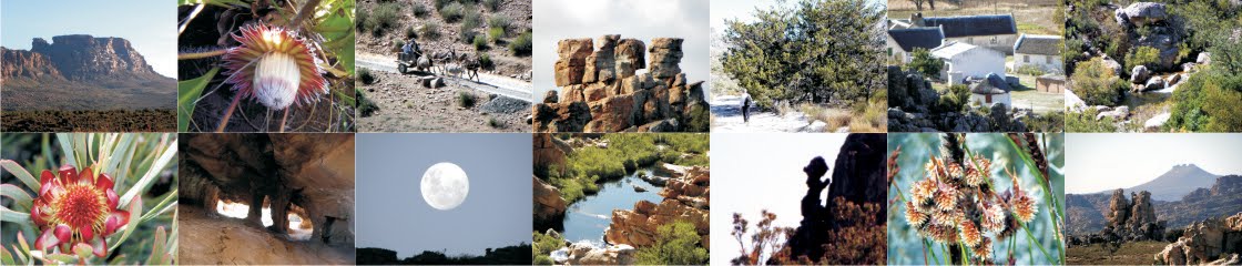
1. Caves located at last!
Great news is that Alex Basson’s ‘Engelsman se Grot’ has been found! The intrepid Dawie Burger and George van der Watt went on a cave hunt recently and have located the cave, used by British Soldiers during the South African War, 1899–1902. The soldiers were responsible for the Pakhuis Pass blockhouse and the off-duty troepies were billeted in the cave. The blockhouse was blown up after the war – its remains litter the rocky koppie behind the parking area, at the top of the pass. The cave is still there and Dawie picked up some old bullets, bully-beef tins, etc. There were slangbos beds in the cave, suggesting that someone else is still using it as an occasional billet – it’ll be clearly shown on Hike the Cederberg #2, out fairly soon.
 |
| Engelsman se Grot: photos by Dawie Burger |
Alex’s own cave, Bassonsklip near the Anvil and the Swemgat below Skerpioensberg, has also been a bit of a mystery – but no more. Alex confessed that when he helped compile the 1981 Forestry Dept map of the ’Berg he deliberately placed ‘his’ cave in the wrong place – along with several other details that, in those days, he felt should remain secret. When we came to editing the new 2013 map Alex, no longer secretive, could not locate the cave with any precision; but Jacques van Rooi of CapeNature, Algeria, has come to the rescue. There’s a clear path to the cave, nogal, suggesting that plenty of hikers know where it is – they just don’t know its proper name! Well, that cave will be correctly placed on Hike the C #2, too.

2. New names for new maps
We recently completed another name-gathering trip, with great inputs from André and Jaen Marais, Arrie Beukes, Oom Joffré Esterhuizen, Johan van der Westhuizen and Dawie Burger. Over 100 new names will appear for the first time on Hike the Cederberg #2, amongst them the true origin of the name ‘Gabriël’s Pass’ – it’s named quite simply after the angel-shaped rock pillar known to the residents of Langkloof as ‘Gabriël’! – so there it is.
[and I’ve lost the picture!]
3. Laurie’s Hell: the true story ...
When we compiled our Cederberg Names blog we were tempted to include, under ‘Laurie se Hel’, the story we’d been told of a lost Eselbank forester named Laurie who disappeared into that rocky maze and never came out ... which goes to show that the Cederberg has just as many k**stories as anywhere else! The real origin [which means reverting to the English name, because Laurie was an Engelsman], is told by his son:
“You cannot imagine my surprise when my brother sent me the link to your site (and to this page: http://cederbergnames.blogspot.fr/2013/07/l.html). You mention “Laurie’s Hell” and wonder about the provenance of the name. I thought my brother and I were the only ones who even knew about Laurie’s Hell, as it was named after my father Laurence Maister (known to everyone as Laurie). He went hiking with one of the original official surveyors of the Cederberg. This might have been in the 40s or 50s. If my memory serves, the man’s name was Ellis Spektor (sp? I also stand to be corrected on the name), and when they got to this location and after struggling through it, my father remarked that it was hellish (or some other remark of that sort). As a kind of in-joke (I suspect) between them, the surveyor christened the place “Laurie’s Hell” on the surveys and that’s how it got its name. I have one of the original survey maps with the place underlined in my home, and up until today thought that it was just some remote area of the Cederberg. I did not know that it was as even vaguely known to outsiders, having not been to the Cederberg in a long time. Anyway, that’s the story. My father died in 2008 and it is really lovely to read of this small memento of his life in the wider world. Best regards Nigel Maister.”
 |
| A tiny part of Laurie’s Hell ... |
4. Cedars: how many are there?
Everyone knows that the Clanwilliam cedars, the cedars of the Cederberg, are a ‘threatened’ species: past exploitation and the ravages of fire have massively reduced their numbers. But how many are left? Ask around and you’ll get answers from a few hundred to a few thousand. We recently completed a survey for the new Hiking map [Hike the Cederberg #2], using the most up to date air photos we could find. The first surprise was that one year after the Dec 2013 fire the great majority of trees in the affected area show up as distinct green dots [the few dead ones show up as rusty brown]. This is indeed good news, implying perhaps that the surviving trees are mainly growing in secure, fire-proof places. The second surprise was the number of dots. We did not count the trees in the remaining cedar plantations, nor those in the occasional surviving dense copse, and of course we could not detect any seedlings this way. We may have also counted in the odd large waboom or Maytenus, but we tried to be super-careful and, when in doubt, left out that dot. The total area covered by the Hiking map produced over eleven thousand ‘cedar dots’ – and it would seem safe to add a fair percentage to that for uncounted trees ...
 |
| A gorgeous cedar, on the shale band above Eselbank: pic by Dawie Burger |
But the real bad news is the botanical name. For years we’ve affectionately embraced Widdringtonia cedarbergensis ... but here’s the shock. A careful search of the world’s herbaria has failed to turn up a single ‘type specimen’ – the absolutely first-ever collection of any species – for W. cedarbergensis. And unless one is found, the botanical name will, according to the time-honoured international rules, have to change to Widdringtonia wallichii.
Can’t see that catching on, myself. Sorry, Mr Wallich.
5. ... and a pear tree without a partridge ...
One of Dawie and George’s explorations revealed the ruins of Peerboom, one of the original subsistence farms from which the residents were callously removed more than a hundred years ago. The great thing about the find is that the ruins are still there. When the Wilderness was proclaimed over-zealous officials attempted to remove all trace of human habitation – they demolished the old Welbedacht and other farmhouses, razing them to the ground [and by all local accounts, stealing all the old cedarwood beams, lintels and floorboards – national corruption is nothing new, you know]. Syferfontein, near Peerboom, was similarly removed without a trace. But no one knew where Peerboom was, with its magnificent stone-walled werf, and so, happily, it has survived. Just as those over-zealous cedarwood thieves could not restore the natural non-human wilderness [did they even try?], they could not totally achieve their ISIS-like aims. Fundamentalist barbarians!
 |
| The ruins at Peerboom, and the Great Wall on the right: pics by Dawie Burger |
6. ... and last but not least, not a Cederberg koringkriek!
If you thought the koringkriek from Wolfberg was weird, try this:

It’s reckoned to be the first accurate reconstruction of a thing called Hallucigenia, an animal with a body-plan like nothing else on Earth – that went extinct more millions of years ago than we can count.
I reckon we should be pleased about that.
Kaartman, July 2015