2. Engelsman se Grot: unresolved
3. Free GPS track to test
4. Which map should be next?
5. A postal miracle
6. Gifberg freebie

1. Nuwejaarsgrot & the Sphinx: resolved
During the pre-publication checking process for ‘Hike the Cederberg’ we agonized for a while over Nuwejaarsgrot and the Sphinx: we had no coordinates. Days after the previous blog was posted Pieter Streicher popped up with this brilliant info:
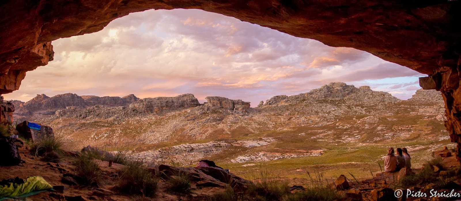
“We hiked to Nuwejaarsgrot near Shadow Peak in the Cederberg this weekend. The coordinates at the foot of the cave is 32° 22' 47" S 19° 09' 53" E. This seems to correspond with this sample map of yours found online: http://www.slingsbymaps.com/images/sample-cederberg2.jpg . We slept in this cave. It will easily sleep 15 people, has a level floor and has clearly been used by hikers with rocks arranged for a cooking area. Your final map shows the cave in a new position (stating position not confirmed) at 32° 22' 53" S 19° 10' 03" E. There might be two caves as my photos indicate another possible cave in this position. Our cave involved some scrambling to access it. The pools in the area are located between 19° 09' 30" E and 19° 09' 50" E.”

I have to thank Pieter for the beautiful pics that duly adorn this blog post.
Pieter Malan followed this up with an account of his own summer trip to the cave:
“Piet Streicher’s beautiful pictures and comments clear up a few of the Nuwejaarsgrot mysteries. I might add that I think the position of the Sphinx is also incorrect on the map. It is the rock pillar visible between the two koppies on the right-hand side of his beautiful picture. And I will be interested to know whether anyone could find the ‘very faint’ footpath on the eastern side of the stream going up to the Sphinx indicated on the map.”
The ‘very faint’ footpath is clearly only visible after veld-fires and has now disappeared: it’ll be removed from Edition #2.
Pieter M also sent us this charming pic of his daughter measuring distances on The Map. Apparently she wants a copy of the map for her next birthday present. An extremely sensible, intelligent and well-brought up child, clearly.

2. Engelsman se Grot: unresolved
The inestimable Alex Basson was a fount of knowledge during the preparation of the maps. However, he has produced one mystery. According to Alex, Engelsman se Grot is somewhere near the summit of the Pakhuis Pass, off the Heuningvlei ‘Noodpad’. Soldiers who manned the SA War fort at the summit [long since demolished] occupied the cave; Alex reports finding old brass buttons, belt buckles, etc. in the cave. Despite extensive searches we have failed to find this cave; what’s more, none of the Heuningvlei and Witwater residents who have travelled that way with donkeys for many years seem to know of it.
Pieter Malan writes: “ ... relieved to note that there is uncertainty about the position of Engelsman se Grot. I searched the area around there extensively. All I could find was a very slight overhang near some bolted climbing routes, almost exactly as indicated on the map – but certainly not enough of an abode to be fit for an Engelsman!”
 |
| Engelsman se Grot: is it somewhere around here? |
There’s a free map in this for anyone who can resolve this mystery!
3. Free GPS track to test
We have it in mind to make GPS tracks for certain routes available, probably on CD or for free download. I’ve put up an experimental freebie on our website; you can download the zip file from http://www.slingsbymaps.com/documents/Pakhuisberg Track and Waypoints.zip [or go to http://www.slingsbymaps.com/cederberg-hiking.aspx#.UteVshCSwfg . In the zip file are four files: a .kml and .kmz for Google Earth, a .gpx of the track and a .gpx of the waypoints. I’d be grateful for some feedback from users of hand-held GPS readers. You don’t have to do the trail: just try loading the track. You might have to download a freebie like ‘Easy GPS’ to do this: http://www.easygps.com/download.asp . Maybe you could email me to let me know whether the track and waypoints show up properly on your unit [or use the Contact page on the website if you don’t have my email].

4. Which map should be next?
2014 is Voting Year! Whether the thought fills you with excitement, dread or sheer boredom you might like to help us make up our minds about a new map. We want to do a new touring map of one of the following this year: Tanqua Karoo, or Richtersveld, or Algoa Bay [Cape St Francis to East London]. The Tanqua links the Cederberg to the Swartberg [Laingsburg would be in the bottom right corner]; Richtersveld is the most romantically well-known but there are other maps available; and Algoa links the Garden Route to the Wild Coast.
Please vote via my email or through http://www.slingsbymaps.com/contactus.aspx#.UteXexCSwfg .
5. Gifberg freebie
Watch out for a freebie map or two of the trails at the Gifberg resort, probably as downloads from our ‘Cederberg Touring Map’ page. I hope to include a gps track for the long Bushman’s Trail, too. It’ll be there in a week or two.

6. A postal miracle
We send out several online map orders every day; we use the ornery SA Post Office and in ten years about two orders have gone astray. Some orders take less than 24 hours to delivery [yes, it’s true!] – most take less than 48 hours. We were thus surprised by the delay but delighted that the mail got through at last, as Martin Hutton-Squire reports:
“A belated thank you for the Cederberg maps you so kindly sent me ... the thanks are kind of late, as although the PO’s date stamp tells me that the envelope was posted on 2013 08 21, it only arrived the week before Christmas! It was in fact the only Christmas present to arrive the old fashioned way, other than down the chimney of course! And those were equally scarce. So thank you for my Christmas present, which will, I hope, be put to a field test some time in 2014. And also thank you for acknowledging so many of us ancient manne, myself included, in your list of credits. It is much appreciated.”
Us ancient manne need to stick together, Martin, in this world of [not so] rapid communication – moenie worry nie.
– Kaartman, Jan 16, 2014