SEE BELOW FOR NEW MAP SHOWING DIFFERENT WAYS OF INDICATING DISTANCES
This second sample “bit of map” shows some Cederberg high country, and the proposed mapping style for the high peaks above the shale band. It’s ready and awaiting your critical inputs, and for that reason I have included a couple of features that some might rather not see included. If you feel that way, please tell. I’m not wedded to any specific info that might appear off the established paths. The “Cederberggrot” is in the wrong place and if I don’t get any further info I will leave it out. “Laurie se Hel should move down a bit, more or less in line with “Eselbank”.
Some explanations:
The map-sample is a condensed jpg file, so do not expect all the linework and lettering to be as sharp as the final printed product [black lines might appear a hazy grey, for example];
colours may not be 100% true, depending upon your monitor settings;
the original is approx. 1:50 000 scale. To reproduce this you need to print or view the map-sample at max. width of 200 mm;
there is no key to the sample [there will be one, of course, on the complete map] so there may be some new symbols that are unfamiliar. Green dots on yellow are the standard paths within the Wilderness; green dashes are ditto jeep-tracks. Broken brown, green or red dotted lines on pale yellow are various classes of “ways to go”, where there may not be an actual path. If there is anything else you don’t understand please contact me via http://www.slingsbymaps.com/contactus.aspx or my email if you have it.
A name in red means we have not located it accurately yet;
there is only a long/lat grid on the map at this stage; there are requests for a UTM grid as well but I’m still working on how to do this without crowding the map too much.
Please send all and any comments to me via the web address above [or my email if you have it]; the map will remain online UNTIL 31 JULY 2012 ONLY, so this is your chance to have your ideas considered and maybe incorporated, too! Just remember, please, that like the first sample this is a tiny fraction of Side One of the map, which will be A1 in size when printed.
I will shortly be publishing another sample piece, this time to show two different ways of indicating distances on the map, for your comment.
 |
| You can also simply click on this image to enlarge it |
http://www.slingsbymaps.com/images/sample-cederberg2.jpg
 |
| Two ways of showing distances; PLEASE comment on which method you prefer. 1. Purple arrow: a small panel that shows distance between path junctions and an approximate time [cf our Silvermine map], or 2. Red arrow: distance to the next junction shown in small red numbers at the intersection; no times shown [cf our old Drakensberg series]. Times are difficult to show with any accuracy, especially for uphill/downhill, etc etc. Click on the map to enlarge it |
 |
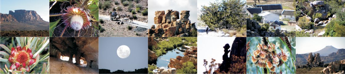
| Vuilpoortjie from the nek below Tafelberg – a daunting sight for a 6-year old who has just climbed up from Welbedacht! |
 |
| Vuilpoortjie [about 1690m] from the shaleband on the Eselbank side. Fancy trying that on a Friday afternoon in February? |
 |
| Lucky contemporary boarders at Eselbank – they [sometimes] get fetched and carried by bakkie or donkey-cart ... |
 |
| Eselbank cottage |
 |
| Eselbank, with Laurie se Hel behind; Tafelberg peeping out, top left. |
Inputs already acknowledged: Rudolf Andrag, Quinton Martins, Ronnie Hazell, Charles Merry, Ezan Wilson, Wim Morris, Alex Basson, Graham Bellairs, Julyan Symons, Galeo Saintz, Paul la Grange, Laurence Elton, Mike Scott, Peter Hart, Justin Lawson, Paul la Grange, David Donald, Johann Lanz, Cisca Nieuwoudt, Torben Wiborg, Sandy MacDonald, Trevor Rennison, Hendrico Burger, Nicky Lombard, Jeroen Kant, Patrick Lane, Ingar Valentyn, Pip Nieuwoudt, Eugene Moll, Greg Moseley, Tony Heher, Andrea and Moritz Connrad, Hennie van der Westhuizen, Isak Koopman, Kerneels Filander, Kellie of Grasvlei, Barry Ockhuis, Joey Ockhuis, Gert Theron, Mary Anne Zimri, Louis Conradie, Haffie Strauss
Let the comments come rolling in ... don’t be shy.
Kaartman, 3 July 2012