
Any info that would help to locate these places photographed by Ken Howes-Howell between 1930 and 1960 would be very helpful; none of them are known to this mapmaker; most are in the MCSA property south of Kromrivier. Click on the pics to enlarge them; use http://www.slingsbymaps.com/contactus.aspx to respond, if you wish.
Four things first: thanks to George van der Watt we have some useful info about Panorama Cave. Second, enjoy this pic of Sneeukop, behind Eselbank, taken on the weekend just past [17 August 2012]. Third, Kunje have come on board and joined the accommodation places that will be on the map. Fourth, I’ll be away for the whole month of September so no more blogs or email replies from me until after October 5th ...

HOWES-HOWELL PICS ...
What info I have is in the captions.
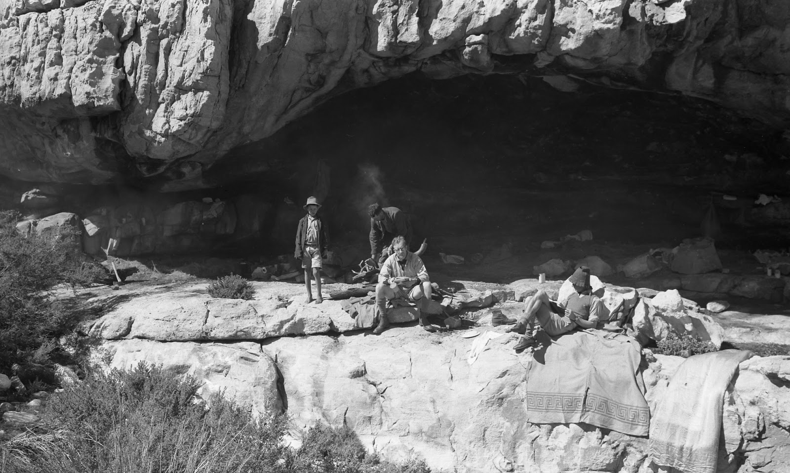 |
| Howes-Howell calls this BUSHMAN’S CAVE; confirmed by many as WELBEDACHT CAVE |
 |
| TWIN BLOCKS below Murraysberg; can you locate? |
 |
| This formation is on ARCH PEAK; where is the peak? |
 |
| This looks like the Camel, but H-Howell says it’s on TOTEM PEAK; ever heard that name? |
 |
| This formation is called HINDENBURG and is near Frustration Peak; can you locate it? |
 |
| KLEIN-BEESGAT ARCH: any info on where it is? |
 |
| ARCH on Moorrees Peak; location?? |
 |
| ELANDSKLOOF WATERFALL; know it? [Not in Elandskloof, it's the waterfall on Waterfall Farm near Citrusdal] |
 |
| ELANDSKLOOF POTHOLES: I presume they are close to the waterfall. Any info? [Not in Elandskloof, these are on Boontjiesrivier Farm near Citrysdal] |
Inputs already acknowledged: Rudolf Andrag, Quinton Martins, Ronnie Hazell, Charles Merry, Ezan Wilson, Wim Morris, Alex Basson, Graham Bellairs, Julyan Symons, Galeo Saintz, Paul la Grange, Laurence Elton, Mike Scott, Peter Hart, Justin Lawson, Paul la Grange, David Donald, Johann Lanz, Cisca Nieuwoudt, Torben Wiborg, Sandy MacDonald, Trevor Rennison, Hendrico Burger, Nicky Lombard, Jeroen Kant, Patrick Lane, Ingar Valentyn, Pip Nieuwoudt, Eugene Moll, Greg Moseley, Tony Heher, Andrea and Moritz Connrad, Hennie van der Westhuizen, Isak Koopman, Kerneels Filander, Kellie of Grasvlei, Barry Ockhuis, Joey Ockhuis, Gert Theron, Mary Anne Zimri, Louis Conradie, Haffie Strauss, Charité van Rijswyck, Chris Berens, Willem Beukes, Kosie Viljoen, Jannie and Katrin Nieuwoudt, Tony Kings, Steven Windell and Louise Esterhuizen, Mare Olivier, Sam Jack, George van der Watt
Looking forward to hearing from you!
Kaartman, August 2012
The first picture is definitely Welbedacht Cave. When I first saw it, I was fairly certain, but I went back to pictures I have of the cave just to confirm that the exact rock formations visible on the lip of the cave match those of Welbedacht. And they do.
ReplyDeleteThe Klein Beeskraal Arch is near the top of the ridge line north west of Sandfontein Peak. I have not seen this particular arch, but I have seen several others in this area - there seem to be many here. I have a picture of one in which the background and the orientation of Sneeuberg in the distance is very similar to the one pictured - and that is how I can determine the approximate location of this one. I will send you my picture. The same arch was featured on the cover of the 1988 MCSA Journal.
ReplyDeleteWe stood on the same arch this past weekend as the arch on arch peak in the picture with the two standing on top of it. It is situated just below the escarpment looking across onto Bloukop in the sandfontein peak area. There is a lovely large cave some 50 m below it. The GPS co ords of the cave are S 32 36 58.9 E 19 14 50.5 to an accuracy of approx 50 m So the arch should be within about 100 m of that. Mike van Wieringen
ReplyDeleteThanks, Mike - won't you send me your email address so I can add you to the mailing list? I use it to notify you of a new "blog".
ReplyDelete- Kaartman