Tuesday, June 3, 2014

Report Back #31: of New Websites, the Tankwa, the Kromrivier oak et al ...

1. New website, new products

2. Tankwa

3. Kromrivier oak tree

4. Cederberg Touring map

5. Cape Leopard Trust

6. Cederberg Heritage Route

7. More about names

1. New website, new products

Big news from Slingsby Maps is that we have a brand new website. Three months in the making, it includes a revolving slide show of photos and maps that’s pretty enough to use as a screen saver – and we’ll be changing the pics from time to time, too. On a first time load, give it a chance – if your ADSL is slow it may take a moment, but once it is in your cache it’s plenty fast. Designed for all modern monitor sizes, tablets, smart phones, whatever gizmo takes your fancy.

With the new site comes a new map – a complete revamp of our Cape Point/Simon’s Town hiking map, now at a larger scale and with off-shore hydrographic info courtesy of the SA Navy, too! It’s A1 size and all copies are waterproof. Matches ‘Hike the Cederberg’, too.

And our final commercial – we’ve also imported a small range of ‘map gadgets’ as aids to hikers and other outdoor enthusiasts – magnifiers, little torches, compasses, etc. See new website!

2. Tankwa

Our fans voted overwhelmingly for our next map to be of the Tankwa, so we’ve been off there researching. If you’re fond of that area, we’ve written up the results of our bouncing around them many wonderful backroads at Maps for Afrika
Hannatjie Sieberhagen of Rooikloof, Sutherland, sent us this pic of her grandson driving sheep down the Ouberg Pass and into the Tankwa.
It’s an annual winter grazing migration

3. Kromrivier oak tree

Rudolf Andrag sent me a lekker article by Bobby Jordan of the Sunday Times, all about the old Kromrivier oak tree. I, too, remember that tree with great affection. I first met it when I was 15, on a hike with friends. There was no such thing as a foam hiking mattress in those faraway days, and I discovered that evening why you should never sleep under an oak tree without one. Talk about the princess and the pea – what about them zillions of ancient, knobbly acorns pressing into your back, your hips, your ...!
Bobby Jordan, however, is a journalist and thus could not help including this extraordinary sentence:  “It was here that a Khoisan painter was caught in the act [of painting a picture] and fled, leaving his tools behind. It is the only known encounter with a Khoisan painter in recorded history ...”
Violins heard offstage left. By the time the early colonists reached the Cederberg the local ‘Khoisan’ painters were only painting with their finger tips. However, there were several recorded encounters with San artists in the Drakensberg [quite far away, I think] including the only known precisely-dated painting – the artist was arrested while painting a record of a ‘Bushman’ cattle rustling that had happened on the day before – 13 December 1848.
Part of Townley-Johnson’s reproduction of the famous Bamboo Mountain painting. In this panel two ‘Bushmen’ lead horses carrying the skins of rustled cattle. Painted in December, 1848, the artist was arrested while still working on his painting.

4. Cederberg Touring map

We’re hard at work here extending the touring version of our Cederberg map to take in Nieuwoudtville, Loeriesfontein and Calvinia, to be published in time for the flowers later this year. To whet your appetite for the daisy-fields of the Agter-Pakhuis and the Biedouw, here’s CJ Opperman’s lovely little contribution:

Op die groot saaidag van die heelal
het reeds ’n entjie duskant Wupperthal
oor die kaal Noordweste
’n sakkie van die Heer se beste
saad per ongeluk gelek, gelek en uitgeval


5. Cape Leopard Trust

Quick congrats from us all to Quinton Martins and the Cape Leopard Trust for their tenth anniversary. Sadly we missed the party – we were over the hill in the Tankwa, admiring the long-term plan to link the Tankwa-Karoo National Park to Matjiesrivier and the Cederberg ... bring it on!

6. Cederberg Heritage Route

This received from Peter Hart, re the AGM of the Cederberg Heritage Route and plans for a bit of hiking at Rocklands and on the Pakhuisberg Day Walk. You can view a YouTube snip about the latter at https://www.youtube.com/watch?v=LxdqZvAcj9g 

Annual General Meeting of the Cederberg Heritage Route: Wed 30th July 2014 in Wupperthal. We would like to take a group of Friends of the CHR up to the Cederberg a few days in advance to do some hiking, stay in the local accommodation and then attend our AGM.

The plan this year is to spend the nights of 27, 28 & 29 July in the newly refurbished self-catering cottages in the Kliphuis Campsite run by Cape Nature near the top of the Pakhuis Pass. The cottages cost R750 per night, so if we have six persons per cottage the cost is R125pppn, or if only four persons R188pppn. The cottages are fully equipped for self-catering and bedding is provided. We can make the self-catering arrangements later when we know who is coming. These cottages may be suitable as the first night's stop for our Pakhuis Trail and for the Cederberg 100 Trail, so we wish to check them out and check a slightly revised routing for the first day of these trails. 

On 28th we thought of a circular day walk ... towards Amon se Poort. At the path "crossroads" turn right again and take the Old Wagon Road path which ends up on the R364 opposite the grave of C.Louis Leipoldt, then walk about 1km back along the road to Kliphuis - about 11km in total according to Slingsby's new "Hike the Cederberg" map.

On 29th we could do the circular walk on the north side of the R364 marked on the map as the Pakhuisberg Day Walk - about 13km. Both of the proposed day walks are quite spectacular. They are both in the Cape Nature Cederberg Wilderness area, so we will need to get permits, which are available at the Kliphuis Campsite. For all who have Wild Cards the permits are free and we also don't pay the so-called Conservation Fee for staying at Kliphuis.

On Wed 30th July those attending the AGM need to be there by about 12 noon, in time to have coffee at the Lekkerbekkie Coffee Shop before the meeting.

I have already made a provisional reservation for these cottages, so please let me know as soon as possible whether you would like to participate in this trip.

Many thanks and best wishes,
Peter Hart.
Chairman/Hon.Sec.
CEDERBERG HERITAGE ROUTE
Tel/fax: (021) 794 6362.
Email: pmghart@iafrica.com
Website: www.cedheroute.co.za
Duiwel se Kruis, at Amon se Poort

7. More about names

Finally, many thanks to Dawie and Lizette Burger of Driehoek who have continued to send in info and alternative explanations for some of the Cederberg place names.

Sunday, March 30, 2014

Report Back #30: Of Dams and Names and Ants and Frolics

I thought I had better get this blog out before April Fool’s Day this year, or you might not believe me. Last year’s blog with its true story of the takeover of Algeria went viral, even though it wasn’t that funny ...
This time round:— 

1. Enlarging the Clanwilliam Dam

2. Some new Cederberg names and other changes

3. Ballerja

4. Of ants and the future

5. Old maps

1. Enlarging the Clanwilliam Dam

The raising of the Clanwilliam Dam wall by 17 metres has been approved by cabinet; there are plenty of implications for road access to the Cederberg, not to speak of the effects on farms like Rondegat and Lebanon Citrus. Rudolf Andrag kindly supplied maps of proposals for the re-routing of some roads, which I have overlaid on our existing hiking map.
You’ll see that there are four proposals [purple roads] for a new bridge or drift over the Olifants at Kriedouwkrans, and three proposals for access to the farms mentioned above, as well as several other tweaks to the existing roads.
I haven’t shown the N7 changes on this map; in brief, the road near Clanwilliam will be rebuilt higher up on the slopes of Bobbejaanskop, passing behind the present Cedar Inn and petrol station.
I have no idea of the time-scale involved here; several years at least, I would imagine.

2. Some new Cederberg names and other changes

Cartographers traditionally assert their right to put names for unnamed features on their maps. If you disagree with this assertion then you’d better start campaigning for two largish continents to be renamed – though I will concede that honouring oneself, as Amerigo Vespucci did on his maps, is a bit iffy. However, any Cederberg fan will have noticed that there are a very large number of features named for individuals, most of them long forgotten, some more than worthy of the honour. It’s in the latter spirit that I intend including two new names on edition #2 of the hiking map [which is still a fair distance away, I hasten to add].
There is a man who has spent his life as a committed friend of the Cederberg. His knowledge of and love for these mountains knows no bounds; many years ago he tramped every square metre of the area mapping the distribution of the cedar trees. In this process he discovered a modest hill – 1202 metres above sea level – where the southernmost population of the endangered cedar occurs. Until now this hill has had no name; on my maps, at least, it shall be henceforth known as Andrag se Kop. It’s the least I can do in return for your generosity in sharing your knowledge and your enthusiasm, Rudolf my friend. [In subsequent correspondence the ever-modest Rudolf has requested that we use the slightly more generalised name Rudolf se Kop for the hillock in question. Makes sense; after all, we don't have the United States of Vespucci, do we? Rudolf se Kop it is, Mr Andrag]

When he was about twelve years old Mark Hanley had a teacher, the late and indeed great Brian Snaddon, who set up a programme to get his pupils out into the wild, to enjoy experiences outside the mundane school-sports-comfort-zone. Brian called his programme the ‘Challenge’; as a young student teacher I had the privilege of assisting Brian with sailing trips at Zeekoevlei; camping out at Noordhoek; hikes up Table Mountain and – perhaps Mark’s first Cederberg experiences – to Kromrivier, Sanddrif and the Stadsaal.
In due course Mark became a geography teacher at Bishops, where he founded an annual event known as the Bishops Epic. The entire Grade 10 class descends upon the Cederberg towards the end of each year to enjoy a programme of physical challenges, conservation initiatives and community engagement, and I would like to think that at least some of Mark’s inspiration came from his old teacher, Brian Snaddon.
Graham Robertson, Bishops teacher, takes up the tale: 
“Mark Hanley passed away in September of 2010 and our plan is that [his wife] Mandy will unveil a plaque in his honour at Traveller’s Rest in front of a tree we planted there in 2010. It will read: 
In memory of Mark Hanley (1956 - 2010), OD and founder of the Bishops Epic. Much loved and remembered by those whose lives he enriched. 
‘It is not the mountain we conquer, but ourselves.’ 
Unveiled by Mandy Hanley, November 2013
“We’ve also set up a fund called the Mark Hanley Education Fund that is being used to assist to pay the High School fees of some of the children we have worked with at Elizabethsfontein Primary – currently two children are benefitting from this and boys who have been to the base we run at Elizabethsfontein are encouraged to find ways to raise funds to increase our level of contribution in this area. We’re hoping this will grow in the years to come.”
A colleague of Mark’s, Philip Court, who is also part of the Bishops Epic, wrote that
“In the year that Mark died Graeme Klerck and I hiked past a beautiful ‘unknown’ waterfall which we decided to name Hanley Falls. The name Hanley Falls has stuck amongst the Epic staff and boys ...”
So there it is. Hanley Falls shall henceforth be so named upon my maps; I can’t think of a more appropriate tribute to a fellow geographer, a former pupil, and another devotee of the Cederberg and its wild corners.
Platkop: pic by Graham Bellairs
Platkop has emerged from old MCSA journals as the forgotten name of the flat peak north of Donkerkloofkop; other names on the map extract such as Beesgat and Die Hoek van Zuurvlei come from the same source. 

3. Ballerja

Rudolf Andrag sent me the pic below of Ballerjafontein at Kromrivier, named, as Ernst Hartwig pointed out to me, for the wild mint plant, or ‘ballerja’ [also sometimes called ‘balderjan’] [Mentha longifolia]
Which is a pity, because there is no ballerja at Ballerjafontein. ‘Ballerja’ also means ‘frolic’, and the idea of a ‘Spring of the Frolic’ at Kromrivier conjures up some interesting images – what did they get up to under those oak trees, in them good old days?
Ballerjafontein: pic by Rudolf Andrag

4. Of ants and the future

Many Cederberg fans will be aware of the role of ants in fynbos ecology, both as distributors of seeds and [more obscurely] as pollinators. The processes involving indigenous species are disrupted by invasive species, which have the ability to wipe out indigenous ants, even species very much larger than themselves. You’ve probably all heard of Argentine ants, but what you may not know is that there may be as many as nine invasive species in the Western Cape. We have a very poor idea of their distribution, but the few studies that there have been indicate a potentially disastrous effect upon a large range of fynbos plant species.
Hence a proposal from Professor William Bond for an ‘Ant Atlas Project’, similar to the highly-successful Protea Atlas project, that would involve volunteers – hikers, campers, mountaineers, outdoorsmen of all kinds – in gathering data that might help us gain a clearer picture of what’s going on down there under our feet.
It’s still very early days, but in the meantime here are a few pics to help those of you who consider that all ants look the same ...

5. Old maps

Chris Berens sent me this 1895 map of the Cederberg area – I hope it is clear enough for the names to be readable. The bad news [for me] is that it shows the old Krakadouw Pass from Clanwilliam to Heuningvlei, but does NOT show the ‘Noodpad’ to Pakhuis ... I may have to eat my words yet, Pieter ....

Enjoy your April 1st!
– Kaartman, March 30

Monday, February 10, 2014

Report Back #29: More about names, more about mysteries

Die Vlei, near Driehoek: looking south to Dwarsrivier

1. Great inputs from Ernst Hartwig

2. Old map of Clanwilliam area proves a point!

3. Help! Some unresolved Howes-Howell pics

4. A silly hoax – and another silly hoax

1. Great inputs from Ernst Hartwig

Ernst Hartwig has been extremely busy sorting out names and features on the maps. First up is his pic of the remains of the little-known SA War blockhouse at the summit of the Uitkyk Pass. I have always wondered whether there was one there – and sure enough, there it is: just a collapsed pile of stones, now, but the circular shape is still clear.

Next, Ernst pointed out that ‘Hartvlak’ in the Matjies River Nature Reserve is in fact a corruption of ‘Hardvlak’. He pointed out that the Wageners of Matjiesrivier often moved there in winter in search of better grazing, and sent these fascinating pics to prove it. Is it too much to hope that CapeNature might restore the old farmhouse?
Hardvlak: then [about 1930?] and now [2008]

Ernst has also been researching the Kromrivier area and the ridges to the south, both in conversation with local ‘oldies’ and also through MCSA journals; here is a summary of ‘name changes’ and other info that will go into Edition #2; some of these have already been posted on the Cederberg Place Names blog.

Ballerjafontein: named for the occurrence there of wild mint (Mentha longifolia)
Bakmakersfontein: the ‘bakmakers’ were wood carvers who carved wooden bowls from waboom wood
Beesgat: should be spelled Biesgat and refers to the whole valley presently marked as ‘Breekkranskloof’ on the map. ‘Beesgat’ campsite will also revert to ‘Biesgat’.
The ‘Beesgatrivier’ shown in the valley south of Frustration Peak is incorrect and will be shown as ‘Hondverbrandrivier’. The entire valley is ‘Dwarskloof’, not just the section near Alsfontein.
‘Die Hok’ near Suurvlakte should be ‘Die Hoek’. The peak marked as ‘Platberg’ 1530m should be ‘Die Hoek van Suurvlei’ [or ‘Zuurvlei’ – I favour the old spellings, myself].
‘Breekkransberge’ will revert to ‘Breekkransrug
The ravine that angles into the Biesgat from the north-west and meets it at the Biesgat Camp is ‘Kruiskloof
‘Waboomskraal’ should be ‘Waboomwerf
Waboomwerf, in the Biesgat

Other changes:
The ridge from Apex Peak to Gideonskop is ‘Zuurvleirug
The high point ‘1611' north of Donkerkloofkop should be ‘Platkop’ [sorry, Torben, that height is right!] [cf Berrisford, MCSA journal 1935]
Sandfonteinkloof or Ravine is the NW – SE kloof south west of the Sandfontein Peaks

Finally, ‘Anonymous’ sent this correction to our info about Elandskloof. Why ‘Anonymous’, good person? Don’t be shy!
“Your Elandskloof entry is incorrect. The Elandskloof Pass ran up the valley and was used by stock farmers moving between the Olifants valley and the Koue Bokkeveld. The Middelberg Pass was only constructed in 1940. In 1861 the DRC purchased Farm 476 Elandskloof to establish a mission station. By 1890 there were 900 people living there, the descendants of freed and runaway slaves and Khoi. The mission was always a financial drain on the DRC and they decided to sell the farm in 1961 to the Smit brothers. The 72 families were evicted, 20 allowed to settle at Allandale. In 1996 the Land Claims Court ordered that the land be returned to the community and a process to resettle 302 beneficiaries has been under way since then.”
Elandskloof, viewed from the Middelberg Pass
Incidentally, Elandskloof appears on maps as early as 1786, possibly because one of the ‘Ou Kaapse Weg’ routes went from Cardouw [near Porterville] to the Olifants valley, then up the Elandskloof and over the nek to the south into the Koue Bokkeveld. There it joined the alternative route that had crossed the Witsenberg near Tulbagh before turning up past Kunje to Sandfontein, Suurvlakte, Biesgat, Kromrivier etc etc.

2. Old map of Clanwilliam area proves a point!

For some time I’ve been convinced that the ‘Noodpad’, the road from Heuningvlei to Pakhuis, was originally opened up at the same time as Bain built the Pakhuis Pass [1877]. However, some maintain that the road was only built by the Forestry Department in the 1950s. Well, I have no info on that, but apart from the obvious fact that Leipoldt named ‘Faith’ ‘Hope’ and ‘Charity’ while riding along that route long before 1950 – the three peaks look dramatically similar from that angle, and only that angle – here’s a snippet from a fascinating map drawn up by the CO of the British garrison at Clanwilliam, in 1900.
I have coloured in the relevant names ....


3. Help! Some unresolved Howes-Howell pics, and a discovery

I still don’t have coords for the ‘Hindenburg’ or the ‘Ventilator’, and now I have this well-built shelter to find, too ... any help, anyone?
Howes-Howell’s mysteries: left: ‘Hindenburg’, labelled ‘Frustration Peak’; top: ‘The Ventilator from Rietkloof Vlaktes’; bottom right: ‘Beesgat shelter’ [he means the wrong Beesgat, south of Frustration Peak]

Good news is that at last I have identified the ‘Brugklip’ above Uitkyk. Although it’s a huge arch, it is very hard to see against the mountain. I have retouched my rather poor pic to make the ‘brug’ a bit clearer.

4. A silly hoax – and another silly hoax

Cederberg residents were recently in an uproar over the discovery of the spoor of a large lion – I am not sure exactly where. The tracks were positively identified by Quinton Martins and Patrick Lane, both experts when it comes to panthers. After much expensive driving around and wasting many people’s valuable time the perpetrator confessed that he’d used plaster casts from a trip to the Kalahari to make the tracks.

As a public service, herewith the tracks of leopards and lions so you can all be sure what that is to the right of the Cross:

Far south of the Cederberg, an anonymous person posted this pic on Tony Rebelo’s excellent ‘iSpot’ website. As there are only about 12 extant plants of this rarest of all proteas, a new population would be a discovery of huge importance. Once again there was much rushing about wasting valuable time and money. At least the perpetrator, a botanist of note, apologised for his silly hoax.

As Mrs Kaartman used to say to her Grade One pupils, “It’s only a joke if I can hear both parties laughing.”

Think on those things, all ye wannabe jokers ...
Kaartman, Feb 10 2014

Thursday, January 16, 2014

Report Back #28: Some mysteries resolved, others remain

1. Nuwejaarsgrot & the Sphinx: resolved

2. Engelsman se Grot: unresolved

3. Free GPS track to test

4. Which map should be next?

5. A postal miracle

6. Gifberg freebie


1. Nuwejaarsgrot & the Sphinx: resolved

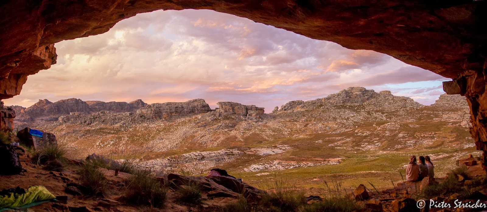
During the pre-publication checking process for ‘Hike the Cederberg’ we agonized for a while over Nuwejaarsgrot and the Sphinx: we had no coordinates. Days after the previous blog was posted Pieter Streicher popped up with this brilliant info:
“We hiked to Nuwejaarsgrot near Shadow Peak in the Cederberg this weekend. The coordinates at the foot of the cave is 32° 22' 47" S 19° 09' 53" E. This seems to correspond with this sample map of yours found online: http://www.slingsbymaps.com/images/sample-cederberg2.jpg . We slept in this cave. It will easily sleep 15 people, has a level floor and has clearly been used by hikers with rocks arranged for a cooking area. Your final map shows the cave in a new position (stating position not confirmed) at 32° 22' 53" S 19° 10' 03" E. There might be two caves as my photos indicate another possible cave in this position. Our cave involved some scrambling to access it. The pools in the area are located between 19° 09' 30" E and 19° 09' 50" E.” 

I have to thank Pieter for the beautiful pics that duly adorn this blog post.

Pieter Malan followed this up with an account of his own summer trip to the cave:
“Piet Streicher’s beautiful pictures and comments clear up a few of the Nuwejaarsgrot mysteries. I might add that I think the position of the Sphinx is also incorrect on the map. It is the rock pillar visible between the two koppies on the right-hand side of his beautiful picture. And I will be interested to know whether anyone could find the ‘very faint’ footpath on the eastern side of the stream going up to the Sphinx indicated on the map.”
The ‘very faint’ footpath is clearly only visible after veld-fires and has now disappeared: it’ll be removed from Edition #2.
Pieter M also sent us this charming pic of his daughter measuring distances on The Map. Apparently she wants a copy of the map for her next birthday present. An extremely sensible, intelligent and well-brought up child, clearly.

2. Engelsman se Grot: unresolved

The inestimable Alex Basson was a fount of knowledge during the preparation of the maps. However, he has produced one mystery. According to Alex, Engelsman se Grot is somewhere near the summit of the Pakhuis Pass, off the Heuningvlei ‘Noodpad’. Soldiers who manned the SA War fort at the summit [long since demolished] occupied the cave; Alex reports finding old brass buttons, belt buckles, etc. in the cave. Despite extensive searches we have failed to find this cave; what’s more, none of the Heuningvlei and Witwater residents who have travelled that way with donkeys for many years seem to know of it. 
Pieter Malan writes: “ ... relieved to note that there is uncertainty about the position of Engelsman se Grot. I searched the area around there extensively. All I could find was a very slight overhang near some bolted climbing routes, almost exactly as indicated on the map – but certainly not enough of an abode to be fit for an Engelsman!”
Engelsman se Grot: is it somewhere around here?
Every other scrap of info that Alex provided has turned out to be correct, but could he be wrong about this cave? Pieter M also writes: “Richard Davies tells me that he and his brother once slept in a cave in the Pakhuis area which had a very distinct centre ‘supporting’ pillar, but was unable to find it again. Maybe that was the Engelsman se blyplek?”
There’s a free map in this for anyone who can resolve this mystery!

3. Free GPS track to test

We have it in mind to make GPS tracks for certain routes available, probably on CD or for free download. I’ve put up an experimental freebie on our website; you can download the zip file from  http://www.slingsbymaps.com/documents/Pakhuisberg Track and Waypoints.zip [or go to http://www.slingsbymaps.com/cederberg-hiking.aspx#.UteVshCSwfg . In the zip file are four files: a .kml and .kmz for Google Earth, a .gpx of the track and a .gpx of the waypoints. I’d be grateful for some feedback from users of hand-held GPS readers. You don’t have to do the trail: just try loading the track. You might have to download a freebie like ‘Easy GPS’ to do this: http://www.easygps.com/download.asp . Maybe you could email me to let me know whether the track and waypoints show up properly on your unit [or use the Contact page on the website if you don’t have my email].


4. Which map should be next?

2014 is Voting Year! Whether the thought fills you with excitement, dread or sheer boredom you might like to help us make up our minds about a new map. We want to do a new touring map of one of the following this year: Tanqua Karoo, or Richtersveld, or Algoa Bay [Cape St Francis to East London]. The Tanqua links the Cederberg to the Swartberg [Laingsburg would be in the bottom right corner]; Richtersveld is the most romantically well-known but there are other maps available; and Algoa links the Garden Route to the Wild Coast.
Please vote via my email or through http://www.slingsbymaps.com/contactus.aspx#.UteXexCSwfg .

5. Gifberg freebie

Watch out for a freebie map or two of the trails at the Gifberg resort, probably as downloads from our ‘Cederberg Touring Map’ page. I hope to include a gps track for the long Bushman’s Trail, too. It’ll be there in a week or two.

6. A postal miracle

We send out several online map orders every day; we use the ornery SA Post Office and in ten years about two orders have gone astray. Some orders take less than 24 hours to delivery [yes, it’s true!] – most take less than 48 hours. We were thus surprised by the delay but delighted that the mail got through at last, as Martin Hutton-Squire reports: 
“A belated thank you for the Cederberg maps you so kindly sent me ... the thanks are kind of late, as although the PO’s date stamp tells me that the envelope was posted on 2013 08 21, it only arrived the week before Christmas! It was in fact the only Christmas present to arrive the old fashioned way, other than down the chimney of course! And those were equally scarce. So thank you for my Christmas present, which will, I hope, be put to a field test some time in 2014.  And also thank you for acknowledging  so many of us ancient manne, myself included,  in your list of credits. It is much appreciated.”
Us ancient manne need to stick together, Martin, in this world of [not so] rapid communication – moenie worry nie.

– Kaartman, Jan 16, 2014

Tuesday, December 3, 2013

Report Back #27


1. Mount Ceder: Cederberg Conservancy meeting

2. Map updates and corrections blog

3. Graham Bellairs: Sandfontein movie

4. Gifberg, gifboom, et seq

5. Koppieshoogte and the Khoi monument

1. Mount Ceder: Cederberg Conservancy meeting

The Kaartmans were invited to introduce ‘Hike the Cederberg’ to the quarterly meeting of the Cederberg Conservancy last weekend. The venue was that great place, Mount Ceder, another one of those which, if you haven’t stayed there yet, it’s high time that you did.
It was Civil Society weekend for us, and if you think all Civil Society organizations are para-political animals, like fighters for AIDS treatment, for better education standards, for dumping e-tolling, etc etc you’d be wrong. On our way into the mountains we visited the Liggiefees at PA Hamlet – it’s an outdoor evening of music and lekker kos and bright and pretty Christmas lights put on by, and in aid of, the local Ouetehuis [Engelsmanne say ‘old age home’]. It did not sound like the sort of thing the Kaartmanne would normally drop everything to attend – but it was an eye-opener. The event drew the communities of ‘Hemlit’ and ‘SĂªris’ together in a really joyful evening that transcended many social barriers, and sparked fresh hope on a weekend when the news was dominated by yet-more evidence of our kleptocratic leaders wallowing in their stolen wealth.
Mount Ceder Rock Art: Top: the famous rhino; bottom: a group of hunters possibly carrying game; a flying antelope. The paintings were damaged early in the twentieth century.
At Op die Berg we diverted for a brief visit to another great initiative – there in the Kerksaal was an expert guitar-player and music teacher voluntarily running a workshop for twenty-odd teenagers from the surrounding farms. I forget [with regret] the name of the organization that raised the money to buy the guitars, transport the boys and girls, feed them and reward them with prizes later, but it was all really good civil society stuff, building communities, developing young people, inspiring hope in the future once again.
And of course at Mount Ceder we sat in on the Conservancy meeting, another civil society initiative that unites the landowners of the Cederberg in an effort to conserve their wonderful environment while developing sustainable tourism, better security, labour development and facilities for the benefit of all. It was a privilege to attend the meeting and the absolutely magnificent dinner that followed; this Kaartman was deeply honoured to receive honorary Friendship of the Conservancy.
   Quinton Martins of the Cape Leopard Trust also graciously conferred upon us status as Creatures worth Conserving – see pic.
Thanks for that, Quinton. 
  Before leaving our comfortable and well-appointed cottage at Mount Ceder we enjoyed a dip in the Grootrivier and a visit to some of the great rock paintings on the farm.
Grootrivier drift: Left, 1948; right: 1972

2. Map updates and corrections blog

After much thought we decided that the easiest way to gather comments, suggestions and corrections to the hiking map was to put up a blog – it deals with all our maps – that lists every problem and/or update that has come to light. Please contribute – all whose suggestions are accepted will be acknowledged in Edition #2. We’re very pleased that Edition #1 is being extensively road-tested by 120 boys from Bishops as I write – we’re hoping for plenty of remarks! We already have several small corrections to ‘Hike the Cederberg’, the most important of which is probably Kunje’s phone number: they contacted us just too late! Go to Slingsby Maps Info to contribute your comments.
Don’t forget to give some time to Cederberg Names – we’re getting a regular stream of visitors there.
Other new blogs are Slingsby Maps Reviews and Slingsby Maps Retail Outlets.

3. Graham Bellairs: Sandfontein movie

Graham sent me a great selection of pics from the remote and glorious Sandfontein area that I felt should be widely shared. We’ve put up a short three-minute movie on YouTube – watch it on full screen, or set it as a screen-saver.

4. Gifberg, gifboom, et seq

A couple of weeks ago we put up a post at Maps for Afrika concerning Gifberg. We know it’s a great place but we were unprepared for the instant, massive response, mysteriously from the USA and from Poland! We realise that ‘gifboom’ is not just a plant, it’s also an app for smart phones, but why Poland? The blog post is already by far the most visited we have ever had, and still growing. It must have been something picked up by the search engines, so here’s a list of some key words on that post, to see whether the same thing happens here!
Gifberg Gifboom Jansu Huisamen Poison Mountain Jacques Tredoux Luca Wiedouw Weimaraner Spook Hyaenanche globosa Namaqualand Putty

If we get another thousand hits in three days I’ll let you know.

5. Koppieshoogte and the Khoi monument

As you approach Op die Berg from the south you pass through a shallow nek between the mountain on your right, and a low ridge on your left. This is Koppieshoogte, an uneasy name for the spot where the severed heads of Galant and his fellow-murderer, Abel, were gruesomely displayed in 1825. Both had been executed at Worcester for their roles in the murder of Willem van der Merwe of Houdenbek farm, the farm school teacher Johannes Verlee and an unfortunate visitor. The three were murdered by Galant and his gang of slaves who had risen in revolt against the farmers at a time when rumours of emancipation had caused unease on many farms. AndrĂ© Brink famously dramatised the whole affair in his brilliant ‘A Chain of Voices’ (highly recommended).
To cut a long story short, on our recent visit we were told that the local Koue Bokkeveld Khoi leadership had recently erected a monument to Galant and Abel at the roadside, at Koppieshoogte.
Koppieshoogte ‘monument’ – I’m not convinced that this isn’t commemorating a road accident victim rather than Galant and Abel ...
I am reasonably certain that both Galant and Abel were of Indian origin, from the Coromandel coast originally, so why they should be so honoured by the Khoi I am not sure – but I digress. The monument was disappointing. I’m not referring here in any disparaging way to the fact that it resembles a pile of stones – such piles often had deep religious significance to the Khoi. What was really disappointing was the wreath. Didn’t the Graeco-Romans invent the idea of wreaths? And roses ... ?
Go figure.
Joy van Biljon of Ceres sent me this report:
Research complete re “monument”.  The man who I thought would know popped in to inform me. Unfortunately he was in a hurry, but here is what he said.
It was erected by the Khoisan Group on heritage day in memory of the Koppies Hoogte event.  The idea is that anyone who wants to, can add a stone as they pass by.  There was a ceremony on heritage day.  The leader for this area is Abre Hector who comes from the Cederberg  and he in turn reports to the chief of the Koranas.  The movement is a loose alliance of different groups who feel they are “first people”.  They do extensive DNA testing and the main aim is to make people proud of their heritage.  They are also busy researching old graves and trying to declare them as heritage sights.   Their logo is something like “the land is the Khoi and the Khoi is the land.”  They have a newspaper called Eerste Nasie Nuus. (There is an example on the web)(link did not work – Ed.)  The local coordinator, Jonathon Coetzee will send me his copy of the article about the monument and I will scan it for you.

Kaartman, December 2013

Wednesday, October 30, 2013

Moritz and Angus

Sad to have to report the loss of two of the Cederberg’s sincerest devotees. Moritz Connrad would have been known to many readers of this blog; he and Andrea contributed valuable insights and information to the new hiking map, even though their farm, Enjolife, fell outside the mapped area. Moritz died tragically in a light aircraft accident a week ago; he leaves his wife and two young children and a host of grieving friends. At times like these we face our hopelessness and helplessness  – we want so much to do something, say something, put this awful thing to rights. We are devastated by the suddenness and the harshness of Moritz’s passing; our thoughts, sympathy and condolences go to Andrea and the children. 
Angus Wilson, a forester of note and devotee of the Cederberg, died while on holiday a fortnight ago. Called out to advise at the scene of a veld fire, Angus suffered a heart attack. At his memorial the parson described Angus as a tall tree in the forest; he was indeed a tree. I knew him for over forty years, and in the early years he gave me many ideas and insights into the areas we were mapping. We shared many close friends with Angus and Gilian, and we followed their fortunes and those of their family in short, early morning chats on Muizenberg beach, while walking the dogs. Our sympathies and condolences to Gilian and the family. Angus was 79; a tree has indeed fallen in the forest.

Tuesday, October 22, 2013

Report Back #25: Not quite the last ... first it's MOVIE TIME!

Can’t seem to leave this Cederberg thing alone. The Cederberg Names blog is pretty much complete and up there for your info [and comment!]; but I recently was asked for GPS tracks, and thereby an idea was born.
It’s worried me that we have this extraordinary set of 16000+ photographs, thanks to Matt Britton, but as long as they are buried on a hard drive they are of no use to anyone. 

And so the plan is to produce a CD [or maybe a DVD, depending on space required] that contains the following:
* Tracks for the major hikes and day walks – probably 30 to 40 of these. These will be in kml format for Google Earth, and gpx format for use in GPS readers. I can’t possibly put them in all the different current GPS-file formats so you would have to download the free converter that suits you;
* a photo-string of 50 to 100 captioned, geo-tagged photos per hike, in kmz format, that can be loaded into Google Earth where they will appear as a string of ‘thumbnails’ along the relevant route; click on each mini-pic to open it up;
* and possibly a slide-show/movie that you can open in Picasa or Windows Media Player of the same photos, for the same hikes.
   The CD will thus allow you not only to plan future trips to the Cederberg but also to glimpse the corners that you may not know. I’m sure that Galeo and others may not like the idea but, if you prefer self-discovery, you don’t have to buy the CD.
An important aspect of Matt’s photos is that they were all taken in the same year [2011] in the same 5-month period [May to September]. They are thus a comprehensive and historic record of burnt and unburnt areas, the state of paths and, very importantly, the state of many of the surviving cedars. The info on the CD will thus become something of an historic record as well.
We have put together a couple of ‘teasers’ as movies on YouTube – these are shortened, 1 min 30 sec versions of the photo-strings proposed above. The music is mostly pretty awful, but we can only afford non-copyrighted freebies here so you may want to turn off the sound ...
Try them – just click on the name:

Heuningvlei Donkey Trail
Sas se Kloof [Kleinvlei to Wupperthal]
Zimri se Pad [Pakhuis to Boskloof]
Krakadouw [Heuningvlei to Groot Krakadouw Peak

and also

1600 Cape Flowers 1 and 1600 Cape Flowers 2 [each with 90 flowers]

... which means that the Corrections Blog will have to wait a little longer ....

Kaartman, 22 October 2013