Tuesday, August 21, 2012

#12: Know these places?


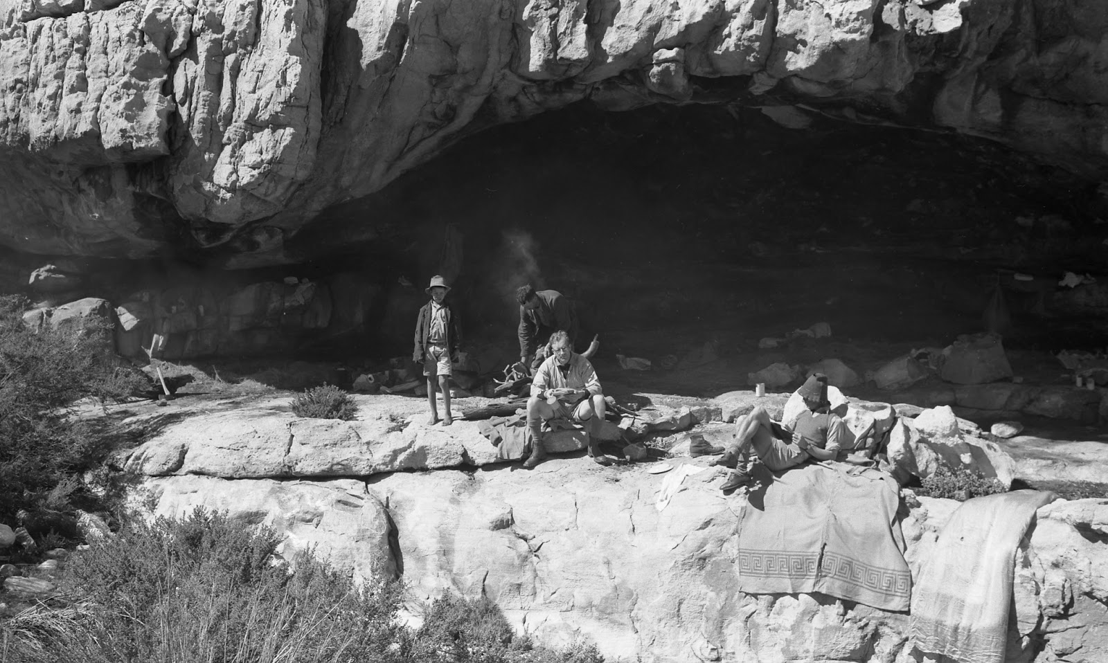
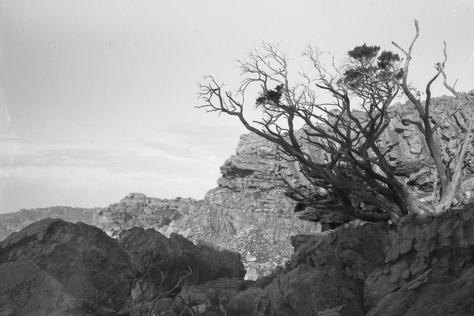
Any info that would help to locate these places photographed by Ken Howes-Howell between 1930 and 1960 would be very helpful; none of them are known to this mapmaker; most are in the MCSA property south of Kromrivier. Click on the pics to enlarge them; use http://www.slingsbymaps.com/contactus.aspx to respond, if you wish.

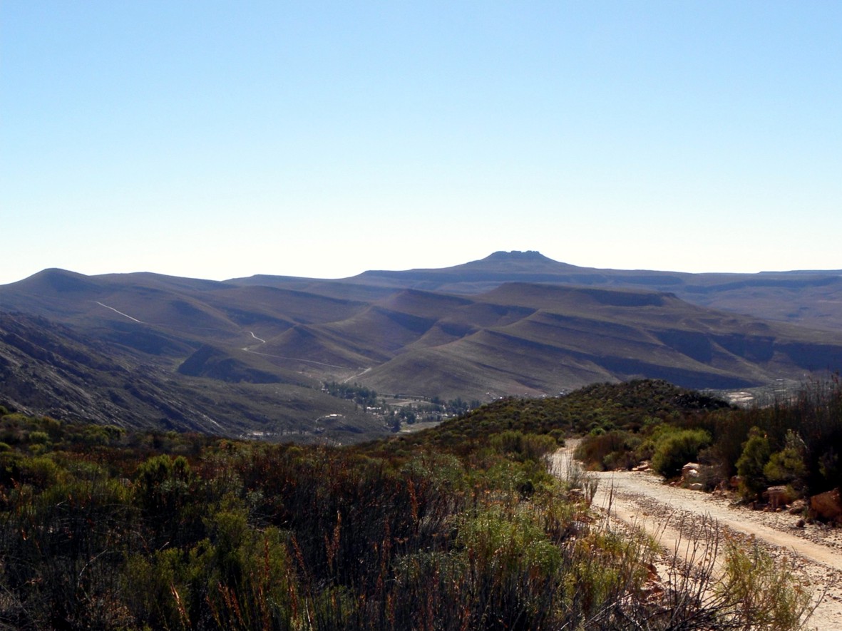
Four things first: thanks to George van der Watt we have some useful info about Panorama Cave. Second, enjoy this pic of Sneeukop, behind Eselbank, taken on the weekend just past [17 August 2012]. Third, Kunje have come on board and joined the accommodation places that will be on the map. Fourth, I’ll be away for the whole month of September so no more blogs or email replies from me until after October 5th ...

HOWES-HOWELL PICS ... 
What info I have is in the captions.


Howes-Howell calls this BUSHMAN’S CAVE; confirmed by many as WELBEDACHT CAVE
TWIN BLOCKS below Murraysberg; can you locate?
This formation is on ARCH PEAK; where is the peak?
This looks like the Camel, but H-Howell says it’s on
 TOTEM PEAK; ever heard that name?
This formation is called HINDENBURG and is near
Frustration Peak; can you locate it?
KLEIN-BEESGAT ARCH:  any info on where it is?
ARCH on Moorrees Peak; location??
ELANDSKLOOF WATERFALL; know it? [Not in Elandskloof, it's the waterfall on Waterfall Farm near Citrusdal]
ELANDSKLOOF POTHOLES: I presume they are close to the waterfall. Any info? [Not in Elandskloof, these are on Boontjiesrivier Farm near Citrysdal]

Inputs already acknowledged: Rudolf Andrag, Quinton Martins, Ronnie Hazell, Charles Merry, Ezan Wilson, Wim Morris, Alex Basson, Graham Bellairs, Julyan Symons, Galeo Saintz, Paul la Grange, Laurence Elton, Mike Scott, Peter Hart, Justin Lawson, Paul la Grange, David Donald, Johann Lanz, Cisca Nieuwoudt, Torben Wiborg, Sandy MacDonald, Trevor Rennison, Hendrico Burger, Nicky Lombard, Jeroen Kant, Patrick Lane, Ingar Valentyn, Pip Nieuwoudt, Eugene Moll, Greg Moseley, Tony Heher, Andrea and Moritz Connrad, Hennie van der Westhuizen, Isak Koopman, Kerneels Filander, Kellie of Grasvlei, Barry Ockhuis, Joey Ockhuis, Gert Theron, Mary Anne Zimri, Louis Conradie, Haffie Strauss, Charité van Rijswyck, Chris Berens, Willem Beukes, Kosie Viljoen, Jannie and Katrin Nieuwoudt, Tony Kings, Steven Windell and Louise Esterhuizen, Mare Olivier, Sam Jack, George van der Watt

Looking forward to hearing from you!
Kaartman, August 2012

Sunday, August 5, 2012

Report Back #11


Time to welcome on board some of the very fine accommodation establishments that ring the Cederberg; and a report back on general progress on the map. There are a couple of questions we need help to resolve too, please.


1. General mapping progress and future time scale


2. Welcoming places to stay on board


3. Know this place? Where’s this place? Rudolf, how about it?


1. General mapping progress


First, thanks for all the many inputs we’ve received on how to show distances and times. It seems most likely that we’ll go for the little panel with distance and approx. time – but a bit smaller than it is on the sample. Any new inputs on this are still welcome.
Second, I’ve had an absolutely great input from Chris Berens, who has produced a great height-shadow screen for Side One, and will do the same for Side Two in due course [see pic].
Chris’s ‘raw’ file [left], and with my
height-shading overlaid [right]
Third, I agreed with Charles Merry that we should not show “suggested routes” at all, eg routes up some peaks where there are no paths. We’re settling upon [a] routes that follow jeep tracks, [b] established paths, and [c] “ways to go” but only where these are old paths that have become faint and hard to find.
Fourth, we’ll be characterising the Cederberg Heritage and the Rim of Africa routes with these little symbols [I’m still waiting for that gps track, Galeo!]:—


Fifth, drawing of Side 2 is well underway. The Google Earth shots for most of this area are of truly lousy quality, but Bing Maps has recently put up a brand new high definition set for the entire Cederberg, right up to date too. There is one problem – some critical areas, eg Wolfberg, are under cloud, and Bing doesn’t have that useful “history” feature.
Sixth, Graham Bellairs has asked for a timescale on production of the map. It’s a tricky one, Graham, because you never know what future problems might arise. I had hoped for Christmas 2012 but I have to be overseas for a month in September which cuts out a slice of time. Realistically, we’ll be in print by Easter 2013, hopefully sooner.
Last, we got more great names from Willem Beukes of Traveller’s Rest [see below], and Kosie Viljoen of Eselbank.


2. Welcoming places to stay


When we produce touring maps we automatically include [at no charge] as many places to stay as possible. However, we decided with a hiking map of the Cederberg it would really only be appropriate to include places that cater for hikers. We emailed all those we know of who  are in the area to be covered by the map; we’ve had an excellent response. We’ll assume that those who don’t reply don’t want to be included ...
Thanks and welcomes are thus owing to:
Agter-Pakhuis: Alpha-Excelsior, Enjo Nature Farm, Traveller’s Rest, and all the Wupperthal buiteposte
Clanwilliam Boskloof: Boskloof Swemgat; Bovlei Guest Farm; Klein Boschkloof and Krakadouw
Olifants and Rondegat Valleys: Cederberg Cottage; Gecko Creek; Grootkloof; Jamaka; Rondegat; Ukholo Lodge
Agterberg: Bakkrans and Keurbosfontein; Cederberg Chalets [Zuurfontein]; Drie Hoek; Dwarsrivier; Kromrivier; Nuwerust
Piekenierskloof & Citrusdal: Boschkloof; Hebron; Rockwood


Special thanks for extra inputs go to Traveller’s Rest, where Willem Beukes showed us around and provided lots of lekker unrecorded names in the Agter-Pakhuis; Jannie and Katrin Nieuwoudt of Jamaka for first class info about their trails; Tony Kings for boundary info for the Cederberg Chalets area; Steven Windell and Louise Esterhuizen of Nuwerust [Cederberg Experience] for great trail info, and similar good trail stuff from Mare Olivier of Cederberg Cottage. Lindon Pope has also promised similar info for Gecko Creek in due course.


Lastly on this, we’ve been unable to find valid email addresses for the following: can anyone put us in contact with them?
Klein-Kliphuis; Sawadee; Little Boy’s Farm [Klein Jongensfontein]; Robyn; Petersfield; Waterfall Citrusdal; Kunje; Berg en Dal; Suikerbossie; Biedouw Farm; Biedouws Guest House; Mertenhof


3. Know this place? Where’s this place? Rudolf, how about it?


[a] On the path past Duiwelsgat, between the Uitkyk Pass and Sneeuberg hut, there is a point on the map named “Sederhoutstasie”. Like many names on the existing maps there is no precision about the location of this historic feature. So, my question: are these pics by Matt Britton photos of Sederhoutstasie? Or is it closer to Uitkyk?
Is this Sederhoutstasie? In the first pic it’s the rocky koppie
surmounted by cedar trees; the view is south towards Sneeukop,
 and Duiwelsgat is down on the right.
Two more views of the same koppie; is this Sederhoutstasie?
 Click on the pics for a larger view.


[b] Sam Jack is doing botanical research in the Cederberg and is trying to find locations for a wonderful set of photos from the 1930s by Ken Howes-Howell. These pics also include many forgotten names; the following is described by the photographer as being “Cedar tree – Dassieberg – Wüpperthal Kloof (1931)”. I assume [but could be wrong] that Dassieberg might be the same as Dassiesbos, the rugged tangle of boulders between Skerpioensberg and Kleinvlei, and that Wupperthal Kloof must be the same as the Sand River canyon that runs down the Vogelgesang Valley just south of the above. Any offers on a location for this pic?
Howes-Howell’s 1931 photo captioned
‘Cedar tree – Dassieberg – Wüpperthal Kloof’ – any offers?


Inputs already acknowledged: Rudolf Andrag, Quinton Martins, Ronnie Hazell, Charles Merry, Ezan Wilson, Wim Morris, Alex Basson, Graham Bellairs, Julyan Symons, Galeo Saintz, Paul la Grange, Laurence Elton, Mike Scott, Peter Hart, Justin Lawson, Paul la Grange, David Donald, Johann Lanz, Cisca Nieuwoudt, Torben Wiborg, Sandy MacDonald, Trevor Rennison, Hendrico Burger, Nicky Lombard, Jeroen Kant, Patrick Lane, Ingar Valentyn, Pip Nieuwoudt, Eugene Moll, Greg Moseley, Tony Heher, Andrea and Moritz Connrad, Hennie van der Westhuizen, Isak Koopman, Kerneels Filander, Kellie of Grasvlei, Barry Ockhuis, Joey Ockhuis, Gert Theron, Mary Anne Zimri, Louis Conradie, Haffie Strauss, Charité van Rijswyck, Chris Berens, Willem Beukes, Kosie Viljoen, Jannie and Katrin Nieuwoudt, Tony Kings, Steven Windell and Louise Esterhuizen, Mare Olivier, Sam Jack


Thanks for keeping up with me!
Kaartman, August 2012

Tuesday, July 3, 2012

#10: Second Sample Map

SEE BELOW FOR NEW MAP SHOWING DIFFERENT WAYS OF INDICATING DISTANCES


This second sample “bit of map” shows some Cederberg high country, and the proposed mapping style for the high peaks above the shale band.  It’s ready and awaiting your critical inputs, and for that reason I have included a couple of features that some might rather not see included. If you feel that way, please tell. I’m not wedded to any specific info that might appear off the established paths. The “Cederberggrot” is in the wrong place and if I don’t get any further info I will leave it out. “Laurie se Hel should move down a bit, more or less in line with “Eselbank”.


Some explanations:


The map-sample is a condensed jpg file, so do not expect all the linework and lettering to be as sharp as the final printed product [black lines might appear a hazy grey, for example];
colours may not be 100% true, depending upon your monitor settings;
the original is approx. 1:50 000 scale. To reproduce this you need to print or view the map-sample at max. width of 200 mm;
there is no key to the sample [there will be one, of course, on the complete map] so there may be some new symbols that are unfamiliar.  Green dots on yellow are the standard paths within the Wilderness; green dashes are ditto jeep-tracks. Broken brown, green or red dotted lines on pale yellow are various classes of “ways to go”, where there may not be an actual path. If there is anything else you don’t understand please contact me via http://www.slingsbymaps.com/contactus.aspx or my email if you have it.
A name in red means we have not located it accurately yet;
there is only a long/lat grid on the map at this stage; there are requests for a UTM grid as well but I’m still working on how to do this without crowding the map too much.


Please send all and any comments to me via the web address above [or my email if you have it]; the map will remain online UNTIL 31 JULY 2012 ONLY, so this is your chance to have your ideas considered and maybe incorporated, too! Just remember, please, that like the first sample this is a tiny fraction of Side One of the map, which will be A1 in size when printed.


I will shortly be publishing another sample piece, this time to show two different ways of indicating distances on the map, for your comment.
You can also simply click on this image to enlarge it
View and/or download the new map-sample from
http://www.slingsbymaps.com/images/sample-cederberg2.jpg 


Two ways of showing distances; 
PLEASE comment on which method you prefer.
1. Purple arrow: a small panel that shows distance between path junctions and an approximate time [cf our Silvermine map], or
2. Red arrow: distance to the next junction shown in small red numbers at the intersection; no times shown [cf our old Drakensberg series]. Times are difficult to show with any accuracy, especially for uphill/downhill, etc etc.

Click on the map to enlarge it
Explanations of Some Names:
Vuilpoortjie from the nek below Tafelberg – a daunting sight for a 6-year old who has just climbed up from Welbedacht!
Some of the names on this sample have interesting stories. “Vuilpoortjie” east of Shadow Peak is the route that was used by school children from Eikeboom, Driehoek, Welbedacht, etc. on their way to weekly-boarding school at Eselbank [the Dwarsrivier/Kromrivier kids used Gabriël’s Pass]. Welbedacht Cave and the now largely-unused Cederberggrot were the only significant shelters along the route. 
Vuilpoortjie [about 1690m] from the shaleband on the Eselbank side. Fancy trying that on a Friday afternoon in February?
Next time you’re toiling up a long uphill slog somewhere in the mountains think of those kids, aged 6 to perhaps 13 ... every Friday afternoon and every Sunday morning they walked that route, forty school weeks a year for six or seven years.
Lucky contemporary boarders at Eselbank – they [sometimes] get fetched and carried by bakkie or donkey-cart ...
Eselbank is a name with a variety of suggested origins. The most common seems to be that somewhere there is a trough-shaped rock that was used to hold the donkeys’ feed. Strangely enough, no one knows where that trough is any more. I prefer the origin offered by Alex Basson, as told to him by the Eselbankers themselves, and so probably true. “Bank” can also mean “ledge” or “overhang” [in the Baviaanskloof “bank” has become “bak”]. 
Eselbank cottage
One day an elderly woodcutter went with his donkeys to collect cedar wood in the rocky jungle known as Laurie’s Hell [or Laurie se Hel – the Lauries are an old Eselbank family]. While sawing timber a heavy tree fell the wrong way and broke the old man’s leg. In great pain he managed to drag himself under an overhang, but was then unable to move any further. No one knew exactly where he was, and his chances of being found in that maze of boulders were zero. But his oldest donkey, a faithful old beast that had been with him for many years, found him there. The donkey set up a braying and a neighing such as only a donkey can, and kept this up all afternoon, all night and into the next day. Alerted by the ceaseless hee-haws the old man’s neighbours sent out a  search party, and brought him home to safety. The tiny cluster of houses became known as “De Eselbank” or “Eselbank” as a result.
Eselbank, with Laurie se Hel behind; Tafelberg peeping out, top left.


Inputs already acknowledged: Rudolf Andrag, Quinton Martins, Ronnie Hazell, Charles Merry, Ezan Wilson, Wim Morris, Alex Basson, Graham Bellairs, Julyan Symons, Galeo Saintz, Paul la Grange, Laurence Elton, Mike Scott, Peter Hart, Justin Lawson, Paul la Grange, David Donald, Johann Lanz, Cisca Nieuwoudt, Torben Wiborg, Sandy MacDonald, Trevor Rennison, Hendrico Burger, Nicky Lombard, Jeroen Kant, Patrick Lane, Ingar Valentyn, Pip Nieuwoudt, Eugene Moll, Greg Moseley, Tony Heher, Andrea and Moritz Connrad, Hennie van der Westhuizen, Isak Koopman, Kerneels Filander, Kellie of Grasvlei, Barry Ockhuis, Joey Ockhuis, Gert Theron, Mary Anne Zimri, Louis Conradie, Haffie Strauss


Let the comments come rolling in ... don’t be shy.
Kaartman, 3 July 2012

Tuesday, June 19, 2012

#9: First Sample Map


Here it is at last: our first sample “bit of map”, ready and awaiting your critical inputs. Before I tell you how to find it, though, some explanations:

  • The map-sample is a condensed jpg file, so do not expect all the line-work and lettering to be as sharp as the final printed product;
  • colours may not be 100% true, depending upon your monitor settings;
  • the original is approx. 1:50 000 scale. To reproduce this you need to print or view the map-sample at max. width of 200 mm;
  • there is no key to the sample [there will be one, of course, on the complete map] so there may be some new symbols that are unfamiliar. Two purple cellphones with arrows pointing to each other indication reception over a path section, whereas a white cellphone means reception at that point only [if you’re lucky]. An upside-down yellow arrow means a bouldering site; a brown dotted line is a path used by boulderers; paths with CapeNature’s area are green dots, others are red. There are grades of path but only the standard “clear path” grade appears on the sample. If there is anything else you don’t understand please contact me at http://www.slingsbymaps.com/contactus.aspx 
  • A name in red means we have not located it accurately yet;
  • there is only a long/lat grid on the map at this stage; there are requests for a UTM grid as well but I’m still working on how to do this without crowding the map too much;
  • there are already two necessary corrections to the map – see below.

See link below to view or download the full-size version of the above
Please send all and any comments to me at the web address above; the map will remain online UNTIL 31 JULY 2012 ONLY, so this is your chance to have your ideas considered and maybe incorporated, too! Just remember, please, that is is a tiny fraction of Side One of the map, which will be A1 in size when printed.
    Below are some pics and comments about the two day walks in the Kliphuis/Pakhuis area that appear on the map-sample, plus a bit more input on that controversial Kruisrivier “path”.  
    We will also publish a sample bit of a high mountain area a bit later – watch out for it.
 View and/or download the map-sample from


The Pakhuisberg day walk starts from the Kliphuis campsite and climbs into the Pakhuisberg north of the Pakhuis Pass. It’s an easy walk over about 13.5 km of wild, infrequently-visited territory with great views, especially on the descent [I’m walking the circuit anti-clockwise]. 
Clockwise from Top Left:
1. The start of the path near the tar road is not clear; look out for the tiny cairn, centre foreground.
. The view down to Kliphuis campsite – now re-opened.
3. Rocky landscapes over the top.
4. A Heeria [Kliphout] and weathered rocks.
Don’t rely upon perennial water, but there are some strong streams after winter. There is one cave-shelter on the path that could shelter two or maybe three people, but it’s not really an overnighting spot.
Clockwise from Top Left:
1. That nervous moment when you realise that the leopard tracks are ON TOP of the boot-print you left there just minutes earlier ...
2. View back to Charity Peak, across the rocks
3. A welcome, but non-perennial, pool
4. Shelter for two, may be three, next to the path
There are great flowers, the fascinating rocks that the Cederberg is famous for, and plenty of wildlife, even frequent leopard-sign. 
Left to Right: A Phylica; an Erica; Leucospermum calligerum. Any offers on the names for the phylica and erica?
You must have a permit from CapeNature to enter the area; it’s part of the proclaimed Wilderness.
Clockwise from Top Left:
1. ‘Secret’ Falls; the waterfall is behind the rockface. This fall on the Kliphuis River is not shown on the sample-map: first correction necessary!
2. On the way back to Kliphuis: gravelly path
3. Dreadful spiny
Aspalathus near Kliphuis; name?? [Pardon the raindrops on the lens]
4. Scree below the Kliphuis Ridge
The Rocklands day walk also starts at Kliphuis, but I’d recommend a clockwise-direction. It’s also a comfortable 13.5 km but you could take a short cut and cut out 3.5 km from your day, thus missing some interesting country. The path ascends the Rheboksvallei parallel to the tarred road, not too much of a problem as there is seldom much traffic. 
Clockwise from Top Left:
1. Klipboom
[Heeria] copse near the Pakhuis Pass summit
2. The Amon se Pad footpath turn-off from the Heuningvlei Road
3. Kruidjie-roer-my-nie
[Melianthus major], a herb used to treat snake-bite and septic wounds; the sap is black and smelly
4. A rocky gargoyle
Near the summit of the pass there is an interesting Kliphoutboom copse, and you briefly join the Noodpad, the “donkey-cart” road to Heuningvlei, before swinging west on Amon se Pad. The route follows the old wagon road over the Pakhuis that predates the modern pass, first built by Bain in 1867. It passes several popular bouldering sites before reaching Duiwel se Kruis, the cross-roads where the Boskloof path descends Amon se Poort to the left. A few hundred metres down the path to the right is a rock-shelter that could sleep up to three adults. It’s on the right of the path, not the left as the sample shows [the second correction!].
Clockwise from Top Left:
1. Fine waboom trees on the path
2. A typical Rocklands chockstone or window

3. Rough repairs to the old wagon-track
 

4. The Gate, the false non-entrance to Amon se Poort
Thereafter the old road – there are several signs of old stonework and repairs – plunges deep into the Rocklands world of outcrops, pillars, cavelets, rock windows, etc etc. It’s all a bit dry, unfortunately, with no reliable perennial water, but the flora is great, especially the many herbs. As you near the Pakhuis Pass you pass through the area where C. Louis Leipoldt and Dr Pieter Le Fras Nortier first successfully cultivated rooibos tea.
Left: Ancient rooibos tea bushes
Right: Pyramid Rock
The path plunges down onto the main road where a cutting has left it dangerous and slippery – repairs needed here, CapeNature, please – and the only way home is a 1km stroll down the tarred road, past Leipoldt’s Grave, to Kliphuis. There’s very little traffic and a high probability of baboons, so the main road walk is not too bad.


Inputs


Not much info has come in since our successful name-gathering in the Wupperthal buiteposte, but we did get this letter from Louis Conradie – with more about that problematic Kruisrivier valley. I’m really unsure about how to deal with this on the map; any ideas, anyone?
I’m sorry I cannot reply to Louis – my system consistently rejects his email address, so please pass this on to him, those of you who know him. He writes [shortened]:
I led a group of 4 hikers on a 7 day CUM Hike-“expedition” doing a big circle starting from Algeria on 5 Sept. 2011 and finishing there again on 11 Sept. 2011.  Only 3 of us finished the whole route as one lady pulled out during day 5 due to feet problems.  The other two hikers who finished the route with me were David Rossouw and his wife, Karen, two very tough hikers, I must say!
On 10 Sept. 2011 we started from the Maltese Cross (where we slept the night of 9 Sept.), following the path to Bakleikraal and down into the valley of the Hekserivier past Riempie se Gat and Dons se Werf.  We lost the path quite a few times, but kept direction as I had already hiked that route in 2008.  On that hike in 2008 we wanted to take the path at the Kruisrivier which crossed over to Algeria, but somehow missed it and finished in the Pakhuispas [Nieuwoudt’s? - Ed] many kms later.
We could not reach the Kruisrivier before dark on 10 Sept. 2011, but on 11 Sept. easily found a path going upstream along the Kruisrivier, which was very motivating.  But not for long!  We soon experienced the same overgrown and almost impassable route as was already reported in your reports – in fact, there was no route at all.  But we wanted to take that route to Algeria, so we struggled upwards in the kloof to the top, doing less than 1 km an hour!  It was really bundu-bashing as I have not experienced at any time in my hiking career
When we arrived at the top of the Kruisrivier after our hectic struggle to get through and over everything, it was really a nice and easy hike down to Algeria.
  I intend doing a 9 day hike in the Cederberg this year again, from 8-16 Sept., and am thinking of including the Hekserivier valley in the hike once again.  Maybe CapeNature, especially Patrick Lane at Algeria, has sent out teams to clear that Kruisrivier path making it hikeable again.  If not, our guts will again be tested to the limit!


Already acknowledged: Rudolf Andrag, Quinton Martins, Ronnie Hazell, Charles Merry, Ezan Wilson, Wim Morris, Alex Basson, Graham Bellairs, Julyan Symons, Galeo Saintz, Paul la Grange, Laurence Elton, Mike Scott, Peter Hart, Justin Lawson, Paul la Grange, David Donald, Johann Lanz, Cisca Nieuwoudt, Torben Wiborg, Sandy MacDonald, Trevor Rennison, Hendrico Burger, Nicky Lombard, Jeroen Kant, Patrick Lane, Ingar Valentyn, Pip Nieuwoudt, Eugene Moll, Greg Moseley, Tony Heher, Andrea and Moritz Connrad, Hennie van der Westhuizen, Isak Koopman, Kerneels Filander, Kellie of Grasvlei, Barry Ockhuis, Joey Ockhuis, Gert Theron, Mary Anne Zimri, Louis Conradie, Haffie Strauss


Let the comments come rolling in, asseblief ...
Kaartman, 19 June 2012

Saturday, June 9, 2012

Special Report: Collecting Names


If you’re a Cederberg fan and you’ve never explored the Wupperthal “buiteposte”, it’s time you did. Peter Hart’s great “Cederberg Heritage Route” traverses a part of this territory, but you don’t need a guided tour to do your own exploring in this lovely “other universe” of thatched cottages, donkey carts and very friendly people. I’ve put up a fuller description with pictures and contact names and numbers on http://mapsforafrika.blogspot.com .
We spent most of a week based at Heuningvlei, interviewing locals and enjoying drives around their beautiful countryside, collecting names for the map. We took as our starting point all the place names mentioned in M. I. Murray’s “Witwater se Mense”. That book is another “must” if you consider yourself a real Cederberg enthusiast: it’s a fascinating account of life in the buiteposte in the 1930s/1940s. It rings with authenticity; it’s a sort of South African “Little House on the Prairie” and it’s a singular tragedy that it has never been translated into English and is not better known. Published by Tafelberg, it’s apparently long out of print but is still in most public libraries. Come on, Tafelberg – skrik wakker, julle.
Heuningvlei seen from the Nougang – a new name on the map!
Back to the place names. Hennie van der Westhuizen and Isak Koopman met us on a frosty morning outside the Heuningvlei Backpackers Lodge: there’s more about this converted school in the blog mentioned above. Hennie and Isak studied the list of names that I’d culled from the book with many a shake of their heads; then suddenly recognition dawned. “Hierdie plekke,” Isak muttered, “is almal naby Witwater!”
Collecting names at Witwater: Kerneels Filander advises
I have to say that for a mapmaker with an interest in social history it was pretty exciting to find that, three-quarters of a century later, residents of Witwater and Heuningvlei still meet on sunny weekend mornings to greet and chew the fat at Sitkoppie, a ridge of flat and comfortable rocks halfway between the two hamlets. In the end Isak located more than 80% of the “Witwater se Mense” names, and those he didn’t know were provided by Kerneels Filander of Witwater. We moved down the valley to Brugkraal, Grasvlei and Kleinvlei, pencilling in Roelant se Hoog, Lêkop, Giel se Knik, Nooiensgat, Mooiweerspoort and more than sixty other names that are not on any maps. Kellie of Grasvlei helped, and a man whose name I unfortunately missed, at Kleinvlei; on the way home via the Oupad we met Barry Ockhuis at Heiveldt, and he gave us Huishout se Gang [and pointed out that essential final ‘t’ in ‘Heiveldt’].
Heiveldt
Sadly, no one knew where Raadhouklip or Kerniekelsfontein once were – any offers? A name that mystified me for a while was “Senrie se Kop”, until Hennie van der Westhuizen spelled it out for me – s-c-e-n-e-r-y .
The Citadel, seen from the Kerskop Pass ... but all the locals call it Tandjiesberg.
Which name is more valid or ‘authentic’?
The next day Joey Ockhuis helped us fill in names on the Noodpad, the popular donkey-cart route between Heuningvlei and the Pakhuis Pass. We were a bit mystified by names like Swartgat [a steep hill] and Potlood se Bank [a stony, level stretch] until it dawned on us that ‘Swartgat’ and ‘Potlood’ were the names of donkeys that had doubtless enjoyed distinguishing asinine adventures at these places.
On the Noodpad Donkey Trail:
Top Left: Gert Theron driving up to Môrehoog;
Top Right: Joey Ockhuis inspanning asses
Bottom Left: Climbing Swartgat;
Bottom Right: Cruising Potlood se Bank
Joey also helped with local names for the road between Pakhuis and Wupperthal; we later found that everyone in the Agter-Pakhuis knows where Onderbaadjie se Draai is – so why on earth is it not on any existing maps [including mine]?
Die Hang: cottage on the Wupperthal road that has never been named on any map
We finished with a trip up the Kerskop Pass to visit the extraordinary Ereboog at Eselbank
Part of Laurie se Hel, the nightmarish slopes of Sneeukop, behind Eselbank. It’s shown in quite the wrong place on all existing maps ...
        Eselbank is less isolated than it once was, thanks to some improvement of the road from Matjiesrivier, but it’s somehow a less apparently-carefree place than many of the other buiteposte. If you’ve ever wondered where Cederberg names like Filander se Werf, Muller se Water, Asjas se Kloof, etc etc come from ... well, those were the names of the farmers forcibly evicted from the Cederberg [without any compensation] by the Cape Colonial Government in 1896. Many of them were resettled at Eselbank; their descendants are less than happy that the 1994 Land Restitution process set an historical cut-off date of 1913 for claims. For the Eselbank families that was seventeen years too late ...
Think about that next time you’re in the ‘untouched wilderness’, and you pick up a rusty piece of an old plough at Grootlandsvlakte, or a piece of blue bottle-glass at Crystal Pool ... our beloved country is, for sure, a very complex place, with many untold stories yet to get out there.
Sowaar.


Kaartman, June 2012

Tuesday, May 22, 2012

Report Back #8


Not a great deal to report this month, but a few gems and, at last! – a momentous milestone in the map drawing.


Ferdi Fischer, of the Mysterious Chockstone fame, is off trekking around Nepal, near Mt Everest, for four weeks while the rest of us seethe with envy. However, in his absence Torben Wiborg has sent in a GPS track with the elusive Chock finally located.


Torben commented: 


Middelberg North is a B-scramble route but without exposure.  Walking from Middelberg Huts towards Machine Gun Ridge, you turn off the well defined path at the neck.  From there we walked straight up to a small rock band through below knee-high vegetation.  From the small rock band there is a very clear line of cairns but no path.  The Chockstone is en route and can’t be missed.  The last section of the peak involves some B-scrambling but without exposure, so it’s fairly safe although slightly awkward.
I think it would be of value to include [the route] on the map as this peak is a three hour round trip from Middelberg Huts and very doable for the more adventurous hiker.”


Many thanks, Torben – it’s inputs like yours that will make this map very special.
Torben Wiborg’s Chockstone, on Middelberg North –
correctly located at last!


Peter Hart sent info about the Cederberg Heritage Route’s Annual General Meeting, to be held in Wupperthal on Wednesday 18 July at 12h30. It’s too late to organize accommodation at Brugkraal or one of the other buitepos houses, but anyone interested could still contact Peter – email address from me, on request.


I received this alarming message from Rob Woodward:


“I am using this channel as I was just looking at some of the pictures on your site. Over the last long weekend I took a group of old toppies from Uitkyk past Duiwelsgat round Sneeuberg to Bakleikraal and then down the valley to Riempie se Gat and Amon se Werf. The paths from the top of the valley below the nek are in shocking condition and have not been maintained for years [my italics]. Beyond Riempies se Gat we lost the path a number of times even though we are experienced hikers. We went up the Kruis Rivier kloof as planned using one of your maps and the old Cederberg map. We crossed the river three times as per the map but the path was also very poor and overgrown in places. After the third river crossing we came to the beacon and followed the path for a while but there has been a fire through and lots of fallen trees. The path has disappeared and we were unable to find the route over the top to Algeria even though we spent about 5 hours in the Kloof [my italics]. In the end we walked through to Niewoudt’s Pass. A great trip but awful and dangerous paths. Perhaps in your dealings with Cape Nature you could mention the issue of path maintenance in this most beautiful part of the Cederberg.”


This is bad news for a mapmaker: how do we characterise those routes on the new map? Do we mark them as paths or merely as “ways to go”? The whole Heks River valley route is far too beautiful to be ignored, with a fine, large cave near Die Kruis. This complaint is similar to that of Laurence Elton – on 2 December 2011 I wrote:


Laurence Elton wrote about his recent [November] trip down the Heks River valley. Just as we did, his party found the Kruisrivier kloof path over to Algeria impassably blocked by fallen trees. His party bailed out to Klein-Jongenskraal and copied us their letter of complaint to CapeNature about the state of a path that is shown so prominently on their map. 
Hmmm. I can see the mapmaker’s biggest hazard rearing its ugly head here – ground features that change and render the map info incorrect ...


Our researcher Matt Britton found his way through in July and September 2011, and again in February 2012, but then Matt is something else when it comes to pathfinding.
Matt Britton’s pics of the ‘path’
up Kruisrivier Kloof – July 2011


There’s a follow-up to our story about the WWII plane crash at Pakhuis in the May, 2012 edition of Go! Magazine, with some interesting pics. The article gives the date as 1946, but all the SAAF sites on the internet give 1945 ...

Finally, we are off to Heuningvlei for a couple of days to pick local brains for place names and many interesting little day walks in that area – you can even hire a guide. The contact details for the Heuningvlei backpacker’s [the old school, beautifully refurbished] are:– 
Dalene van der Westhuizen, 027 492 3070. The cost is only R130 pppn; we’ll let you know more after our trip!


And now for the BIG ONE about the map ... the redigitizing and contouring of Side 1 of the map is finally finished! It’s been a bigger task than I imagined and, with Side 2 still to go, I’m afraid the publication date moves back to December 2012 at the earliest.
Revised contour digitizing for Northern
Cederberg. The straight lines will not
 appear on the map!


The next step will be a sample section for your inspection – watch this space for a downloadable piece of map, probably the day walk north of the Kliphuis campsite [Pakhuis Pass]. I hope this will be ready in about 3-4 weeks and I’ll be asking for your comments.


Already acknowledged: Rudolf Andrag, Quinton Martins, Ronnie Hazell, Charles Merry, Ezan Wilson, Wim Morris, Alex Basson, Graham Bellairs, Julyan Symons, Galeo Saintz, Paul la Grange, Laurence Elton, Mike Scott, Peter Hart, Justin Lawson, Paul la Grange, David Donald, Johann Lanz, Cisca Nieuwoudt, Torben Wiborg, Sandy MacDonald, Trevor Rennison, Hendrico Burger, Nicky Lombard, Jeroen Kant, Patrick Lane, Ingar Valentyn, Pip Nieuwoudt, Eugene Moll, Greg Moseley, Tony Heher, Andrea and Moritz Connrad


Enjoy the wintry weather!
Kaartman, May 2012

Tuesday, April 17, 2012

Seventh Report Back


Wow! The responses to my Sixth Report were déjà vu all right! Reminded me of the Committee of Seventeen who Advised and Argued over what should or should not be included in the Drakensberg maps of the 1980s. Then as now it was the minimalists versus the maximalists. In the end we opted for more rather than less – and now even Galeo has conceded that that might be necessary for the Cederberg.
My favourite all-time
minimalist map – or does
it have too many dots?
We have to bear in mind that the Cederberg, although a legally-proclaimed Wilderness, is nevertheless a very, very altered landscape – if it’s “pure” wilderness you want, with no paths, blockhouses, huts, sawpits, old leopard traps, ruins, graves etc etc then you should really rather be in the Kogelberg, or the Riviersonderend mountains.


Which is not in any way to deny the Cederberg its very, very special magic, but its “Wilderness” status carries two important implications. The first, as many correspondents pointed out, is that there are limitations on access in a Wilderness. Only a certain number of people are allowed on any given night. The booking system means that there is a way to follow up on miscreants, if necessary; the sheer distance from major population centres also insulates the range in a way that does not hold for the Peninsula or many Boland mountains.


The second is that a proclaimed Wilderness has no signposts, no awful little white footprints painted all over the rocks. Navigation for the newcomer can only be by map; and even amongst the old-timers there are few who can claim to know every inch of the vast Cederberg area. To be safe and effective there is a necessary level of info that the map must contain; if the only way to correctly identify routes is by means of landmarks these need identifying names, too – be they prominent rock pillars, pools or whatever.
This map shows why Wupperthal, Cederberg,
is the destination I personally prefer ...
The list of places I published last time remains posted below, and it remains open for comment. One of these days I will be publishing a list of “new” or “disputed” names for some features, and that, ladies and gentlemen, is when the fat will really be in the fire ...


In the meantime, thanks to everyone who sent in comments last time – they were all very much appreciated. If you have further comments, anyone, please keep them coming, but I shall be away from 20 April to 3 May so don’t think me rude, please, if you get no responses during that time.


I keep forgetting to mention that quite a long time ago Andrea and Moritz Connrad of Enjo Life [in the Biedouw valley] sent me a useful map of the summit of Krakadouw. The original was by Ernst Lotz and I gather was published in an MCSA Journal some years ago. It will be very useful: many thanks, you two.


Oops! I also forgot to mention that if you’re really interested in the philosophy behind mapping you should read J. Brian Harley on maps, an extract from ‘The Iconography of Landscape’, edited by D. Cosgrove and S. Daniels, Cambridge UP, 1988, published as chapter 8 in ‘Geographic Thought: A Praxis Perspective’, edited by George L. Henderson and Marvin Whitestone, Routledge, 2008. It’s a snip at $199.50 [yes, that’s US dollars] but I’m sure someone like Martin H-S could lend you his copy!
If you’re really interested, of course.


Info already in:
Already acknowledged: Rudolf Andrag, Quinton Martins, Ronnie Hazell, Charles Merry, Wim Morris, Alex Basson, Graham Bellairs, Julyan Symons, Galeo Saintz, Paul la Grange, Laurence Elton, Mike Scott, Peter Hart, Justin Lawson, David Donald, Johann Lanz, Cisca Nieuwoudt, Hendrico Burger, Nicky Lombard, Jeroen Kant, Patrick Lane, Ingar Valentyn, Eugene Moll, Greg Moseley, Tony Heher, Andrea and Moritz Connrad


Have a great Freedom Day weekend!
Kaartman, 17 April 2012

Monday, April 2, 2012

Sixth Report Back


Debate this, please! As the map progresses it becomes clear that there are wide differences of opinion about what should be on the map, and what should not.


A couple of weeks ago I received this email:
While I do enjoy and appreciate your maps, I do worry about showing the hoi polloi how to find all the best gems in our wonderful mountains. The mob should be restricted to the main routes, and the best parts left to those who can find them for themselves.’


I’m sure my friend’s tongue was at least partly in his cheek. ‘Hoi polloi’ means ‘the many’ in Greek, and we were all hoi polloi once, even my friend. By good luck we were all introduced to the magic of the Cederberg by someone else – and hence we were welcomed into the hoi oligoi [the few].


My guru, Alex Basson, confessed that when he helped the Forestry Dept put together the 1981 map he deliberately scattered place names vaguely across the map without pinpointing their locations, because he too did not want the hoi polloi to find the ‘best gems’ in his wonderful mountains. However, he has appealed to me to include as much of his knowledge and wisdom as possible in the new map, before it gets lost forever. Part of the cartographer’s duty is to find and preserve place names; Alex appreciates that.


Patrick Lane, Wilderness Manager at Algeria, pointed out an important management problem in the Cederberg. ‘Most visitors,’ Patrick said, ‘want to visit the Maltese Cross, the Cracks, the Wolfberg Arch ...’ – leading to increased degradation of the paths to those places. ‘We need to highlight other features, to spread the load,’ Patrick said.


Finally, we have to consider that the Cederberg is a proclaimed Wilderness. This not only means that the number of overnight visitors [hoi polloi or not] is limited, it also means that by definition there are no signposts and, strictly speaking, there should be no huts or even paths. The only safe way, therefore, that anyone – hoi polloi or ologoi – can successfully negotiate routes in them thar hills is if they have an informative and reliable map.


Before listing the specific places for which I would like your inputs in this debate, please also consider this. When I produced my first map of Table Mountain I was asked by MCSA members to specifically exclude certain ‘best gems’ from my map [remember that, Greg?]. For nearly forty years I have not shown such places as Tranquillity Cracks on my map. The map is approved by the MCSA and it’s the only map of the mountain endorsed by SanParks – yet Tranquillity Cracks are nowhere to be found on it. Despite that, at least two popular hiking authors have published detailed descriptions and directions to the Cracks, and Full Circle mag published six pages of photos. Where does that leave my map? Red faced, if it could be, I reckon; sadly on a par with deliberately-distorted maps published in such great democracies as the USSR ...


If you know the following places and you don’t think / do think they should be included on the map, now is your chance to tell me. Please give coordinates if you can, to make sure we are talking about the same place. If you have other places you think SHOULD be included, please let me know [but bear in mind that no caves with rock art will be shown].
Here goes [these are all on the northern section, at this stage; NB these are all names not on existing maps; new names used by boulderers are not included; none of the caves listed below have rock art]:—


  • Ambraal se Vrou [rock formation nr Heuningvlei]
  • Amon se Kerk [rock formation nr Amon se Poort]
  • Asjas se Grot [cave near Crystal Pool]
  • Cederberggrot [near De Hoek, Vaalfontein path]
  • Chockstone [Middelberg North]
  • Dasklip [nr Amon se Poort]
  • Die Punt [nek nr Kleinvlei]
  • Die Rondegat [cave on Rondegat river]
  • Eenboom se Kamp [at Grootlandsvlakte]
  • Engelsmansgrot [cave near Pakhuis]
  • Eselbank Cave [nr Eselbank]
  • Geelgrot [cave at Krakadouw fort]
  • Houtkappersgrot [cave s-east of Sneeukop]
  • Kabouterland Cave [near Grasvlei]
  • Klipboombos [nr Pakhuis]
  • Koupoort Cracks [nr Klein-Koupoort]
  • Kruidkop [nr Amon se Poort]
  • Minor Arch [near the Maze]
  • Nuwejaarsgrot [cave near Shadow Peak]
  • Old Magazine [building nr Pakhuis]
  • Panorama Cave [above Welbedacht]
  • Pepper Pot [pinnacle near Welbedacht]
  • Perdefontein [nr Kliphuis]
  • Poon se Val [waterfall nr Sandwerf]
  • Slangbossloep [path section]
  • Strydom se Pad [Welbedacht to Uilsgat path]
  • Tierhoek Falls [waterfall]
  • Tierhoek [ruins nr Die Toring]]
  • Vensterklip [nr Amon se Poort]
  • Vuilpoortjie [nek near Shadow Peak]
  • White’s Rock [or White Rock] [above Agter-Warmhoek]
  • Winston Pinnacle [near Sas se Hoek]

More names may be added in due course; please send in any others you want excluded or included.


This website map correctly locates Panorama Cave
A note on Panorama Cave is appropriate, as two contributors have asked for it to be excluded:
1. It’s shown on all existing maps, albeit in the incorrect position;
2. It is correctly located on the public wallmap in CapeNature's Algeria office;
3. It is openly advertised at Driehoek, where they’ll even point its location out to you;
4. Jeroen Kant has pointed out that if you go to Driehoek’s website you can download maplets, three of which correctly locate Panorama Cave [see above] – http://www.cederberg-accommodation.co.za/hiking.html
How can I leave this cave off my map?


PLEASE send all and any comments through the Contact form on http://www.slingsbymaps.com/contactus.aspx


Report Back #6


Had a great response to my many requests in #5. Graham Bellairs came up trumps with the Chockstone, and he and Sandy MacDonald both sent pics.


Graham also sent a host of great pics; some copied here to whet the appetites of all who’ll be spending long weekend time in the Cederberg soon.


Pics by Graham Bellairs


Torben Wiborg and Trevor Rennison sent me some very useful GPS tracks for various trailheads/peak tops and routes which I had hoped to include but which are faint on the ground these days.


More pics by Graham


Peter Hart sent me the correct spelling of Ingar Valentyn – sorry I had it incorrect, Ingar. He also located Kroekedam for me.


Looking forward to your input on the names – all inputs will be acknowledged, and please don’t be afraid to say what you think!


Info already in:
Already acknowledged: Rudolf Andrag, Quinton Martins, Ronnie Hazell, Charles Merry, Wim Morris, Alex Basson, Graham Bellairs, Julyan Symons, Galeo Saintz, Paul la Grange, Laurence Elton, Mike Scott, Peter Hart, Justin Lawson, David Donald, Johann Lanz, Cisca Nieuwoudt, Hendrico Burger, Nicky Lombard, Jeroen Kant, Patrick Lane, Ingar Valentyn


Kaartman [April Fool’s Day was yesterday, this doesn’t qualify, hey], 2 April 2012